September seemed to be the month of the hurricane with Florence churning its way towards the Carolina coast. Fortunately the GIS community is always prepared and ready to help on the digital front!

The hurricane program at Esri is an impressive collection of data, sample applications, community-based efforts, and ideas for future development.
![]()
SymGEO used Esri Living Atlas content to produce a mobile-responsive Hurricane Tracker application showing the forecast path of the hurricane.
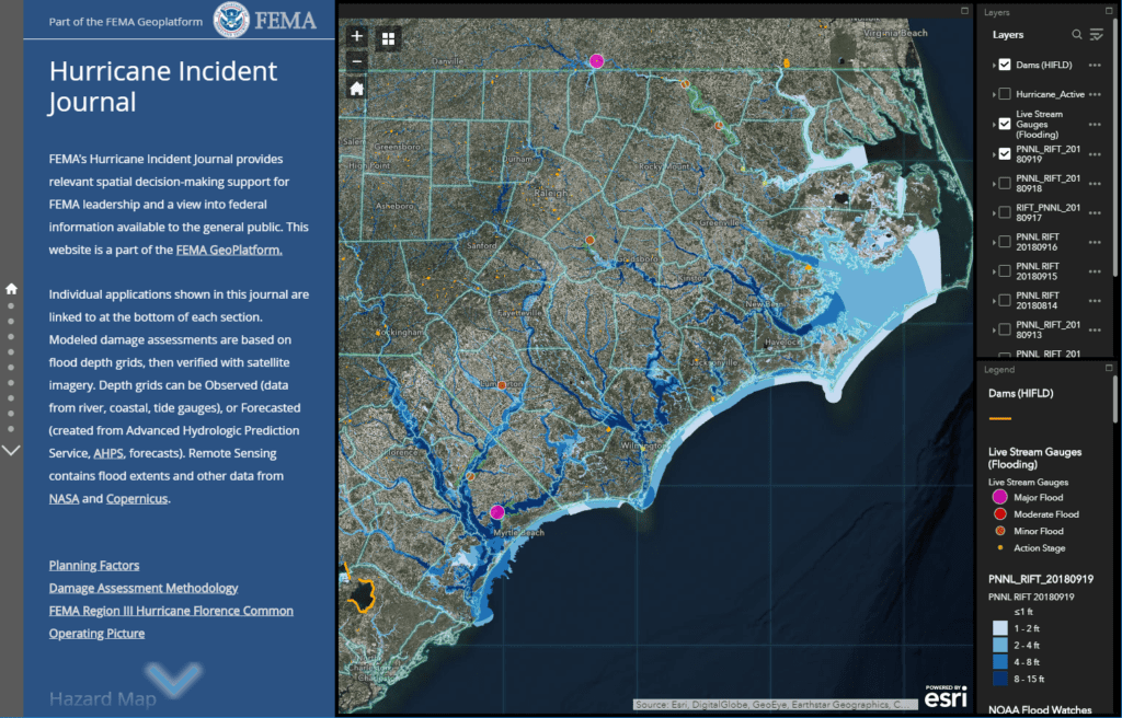
FEMA’s Hurricane Incident Journal provides relevant spatial decision-making support for FEMA leadership and a view into federal information available to the general public.
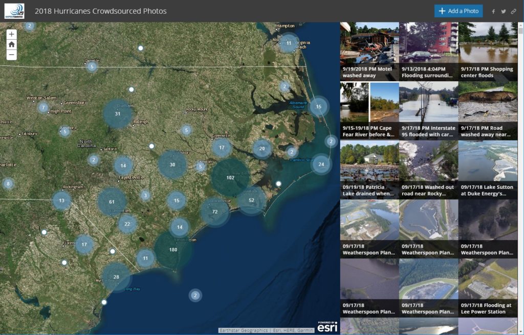
The National Alliance for Public Safety (NAPSG) and GISCorps sprang into action to produce an insightful crowd-sourced photo application to document damage and help direct relief efforts.
Have an idea for a project? Shoot us an email with project ideas or requirements as we’re here to help, and enjoy the fall season!