3D building production

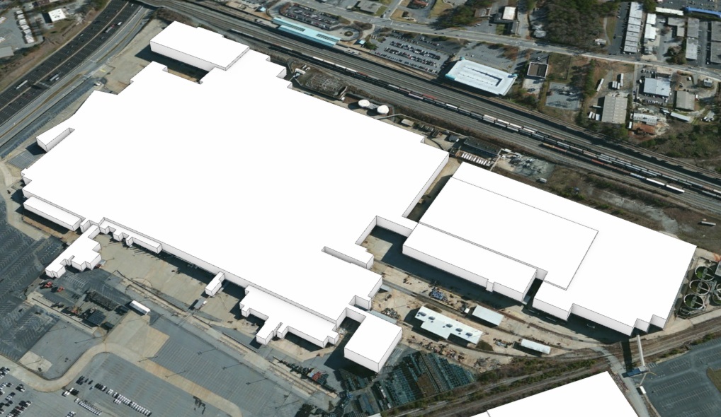
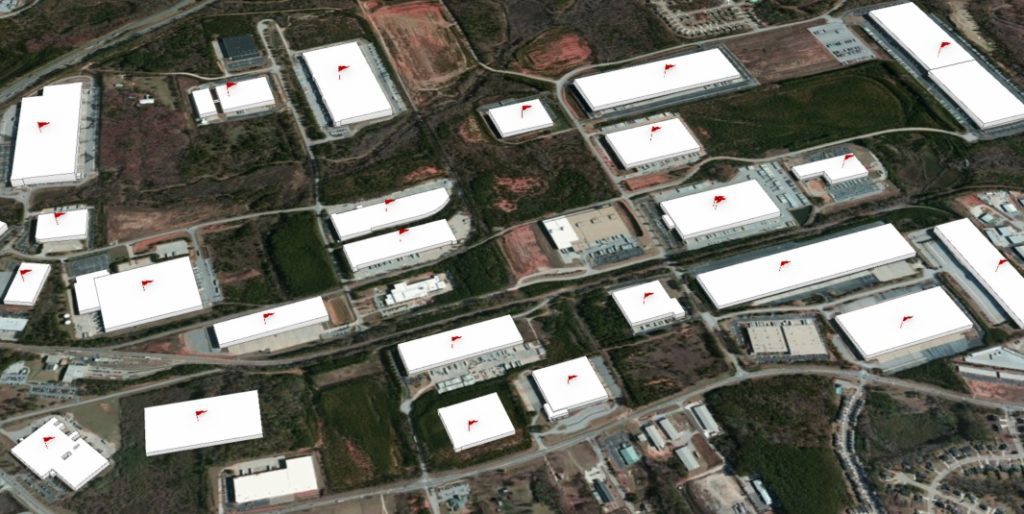
SymGEO was honored to work with a leading commercial real estate broker to identify and construct almost 1500 industrial buildings in 3D. Using a provided list of addresses, the buildings were geocoded using ArcGIS Pro and visually inspected to validate the location. We then used Esri’s “World Image Clarity” basemap and ArcGIS Pro editing tools to construct building footprints and to segment them based on roof shadow lines. Roof heights were assigned based on known values or were given a default value if unknown. Buildings ranged from “quite simple” to “reasonably complex”, but we worked tirelessly to complete the task!
“Thanks again for all your work on this.”
– Program Manager, Client Confidential
Contact SymGEO for your 3D digital needs and start a conversation today!
Targeted marketing with ArcGIS

Have you ever wondered where the best places to market your services are? Sifting through a list of thousands of potential contacts can be rather daunting, but fortunately, ArcGIS geocoding can bring that task down to a manageable size.

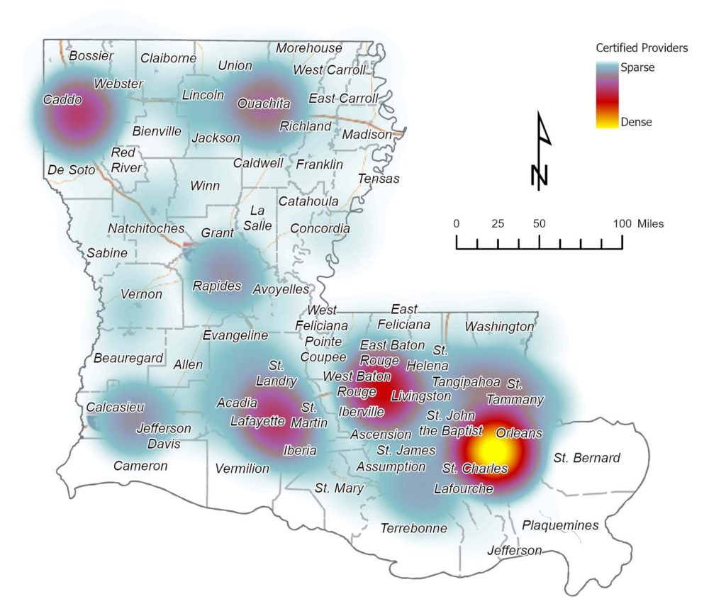
SymGEO recently worked with a confidential medical group to identify provider locations and potential targets that included rural health clinics, medically underserved areas (MUA), medically underserved populations (MUP), primary care facilities, dental care facilities, and mental health facilities. This information was then cross-correlated with ten thousand certified and licensed providers to determine the optimal areas for marketing campaigns.

“That’s perfect! This has been a lifesaver.”

– Client Confidential, medical services marketing

Due to the sensitive nature of this information, we can only share generalized graphics, but the power of GIS and locational analysis saved time, energy, and money during the sales and marketing process.

Contact SymGEO today with your sales and marketing needs!


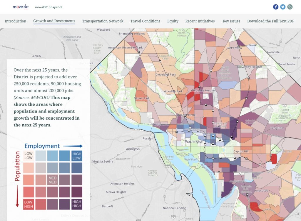
MoveDC Snapshot StoryMap

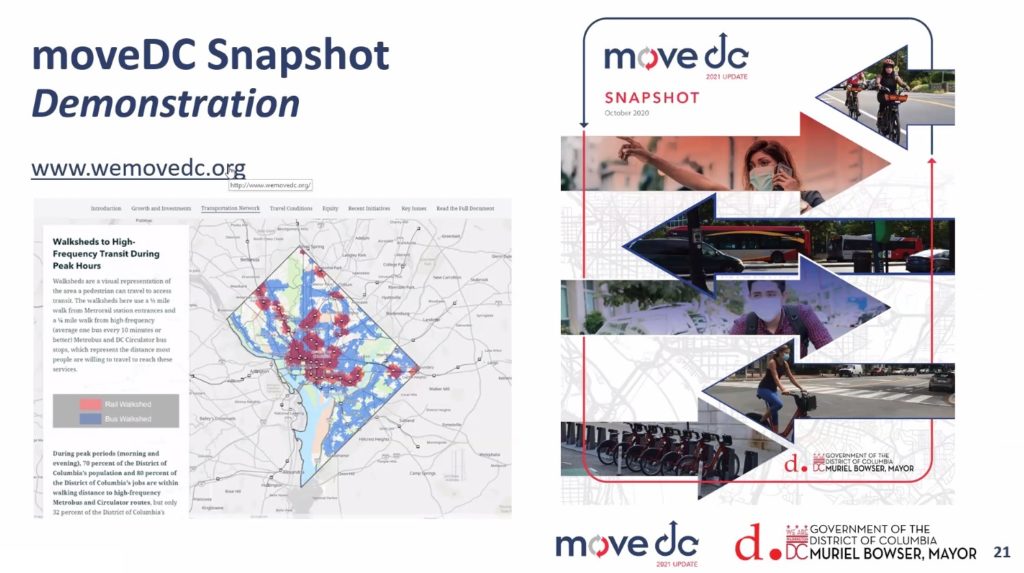
The District Department of Transportation (DDOT) has launched moveDC 2021, the long-range multi-modal transportation plan for Washington DC. As part of this launch, DDOT held Virtual Townhall meetings to discuss the transportation network’s existing conditions within the District and solicit resident input on DDOT’s goals and policies.

We were very excited to see our moveDC Snapshot StoryMap featured prominently during the Townhall meetings! Produced in partnership between SymGEO, Kimley-Horn, Foursquare ITP, and DDOT, this dynamic, interactive, and engaging method of presentation was perfect to capture the energy and data that has gone into moveDC 2021.

“Wow, this looks so good in StoryMap form! I love it!”

– DDOT Project Manager

We used the sidecar functionality of the latest ArcGIS StoryMap framework as a key component to deliver both guided, instructional narrative and interactive mapping at the same time. Mapping symbology was set in the ArcGIS Online web maps while complex legends were imported as images to facilitate visual interpretation of the data.

Talk to our industry experts today if your agency or organization is interested in community engagement with the power of Esri’s ArcGIS StoryMap technology – SymGEO is here to help!