Client: DC Trail Rangers
Challenge: Trail Rangers are a consistent and helpful presence on DC’s mixed-use, paved trails, charged with assisting trail users, improving trail conditions, and working with local agencies to keep the trails clean, bright, and clear of obstacles. To record their daily helpful activities, every trail service, maintenance task, work order request, or trail-side event needed to be captured by location with optional notes or photographs and tagged to the appropriate trail.
Solution: SymGEO configured and deploy an ArcGIS QuickCapture application for the DC Trail Ranger nonprofit team to facilitate the data collection process and quantify work efforts, and then used the collected data to populate a public-facing dashboard. This work was featured in the Esri case study “GIS-Driven Initiatives Promote Active Transportation in Washington, DC“.
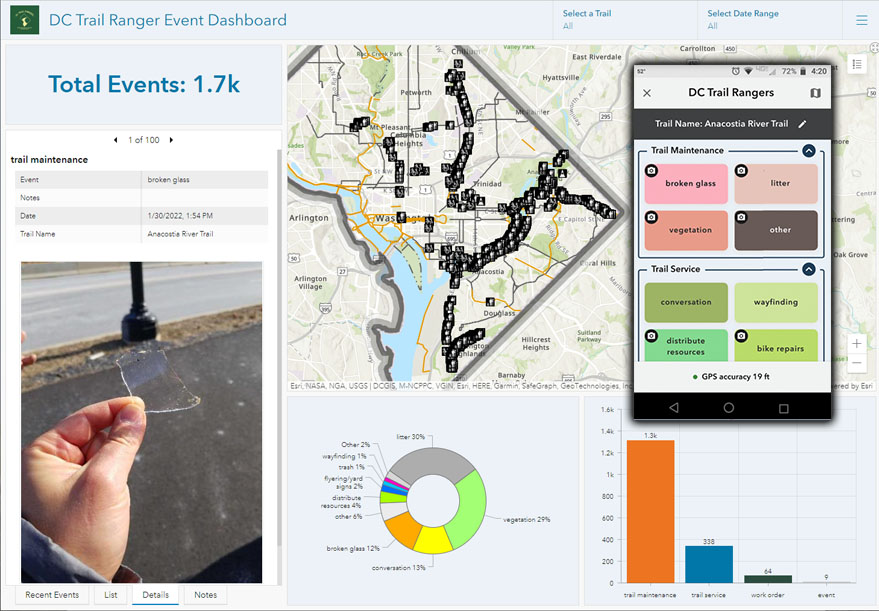
Client Feedback: “As a field team that does a wide variety of outreach and maintenance tasks, ArcGIS QuickCapture has been great for record-keeping and storytelling of program impact. I can confidently say that staff stopped to sweep up broken glass in February 97 times!” – Trail Ranger and Outreach Director, Washington Area Bicyclist Association