May News 2019

The sunshine is here and pools are open – come celebrate summer with us and see the GIS technology grow at SymGEO!

The month of May saw some great product releases for our DDOT and APTA clients as well as a detailed article about our work from Esri ArcNews. Check it out!

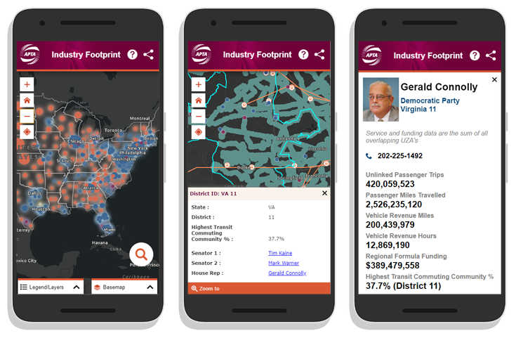
The SymGEO team was honored to redesign the flagship custom mapping application for the American Public Transportation Association (APTA) called the Industry Footprint. This application is designed to explore APTA membership, public transportation providers, transit service, manufacturing and supply chain, and congressional / legislative information. There is a wealth of information packed into one application!

Read more


SymGEO was excited to help the District Department of Transportation (DDOT) Urban Forestry Division (UFD) develop a new initiative called “Urban Wood Reuse: for Schools“. This program will provide DC Public Schools and public charter schools with wood products to improve school grounds at no cost.

Read more


SymGEO was very pleased to have our community engagement pilot project Downtown: Energize! Kentlands featured in the 2019 ArcNews Spring edition!  This premier hard-copy and digital publication by Esri has a circulation of 900,000 industry professionals and is a go-to source for all that is new and innovative in the Esri GIS community.

Read more


Check out these and other recent projects on our site and contact us when ready for the SymGEO experience!

November News 2018

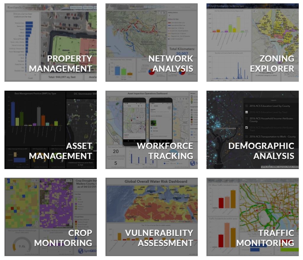
At SymGEO, we love our dashboards! What better way to present interactive and actionable data, styled to perfection and updated in near real-time? This month we thought we’d take a look at some of the dashboards that we’ve configured over the past year, as the technology has been improving rapidly!

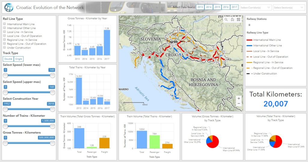
The newest member of our dashboard family was created for the World Bank to help analyze the rail network in Croatia. What started as a number of spreadsheets and a dream, turned into a fully interactive site that will help Croatia identify risk and prioritize upgrades to their network.

Read more


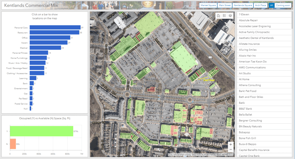
Keeping track of hundreds of commercial properties and identifying retail opportunities through gap analysis is fun and easy with configurable dashboards.

Read more


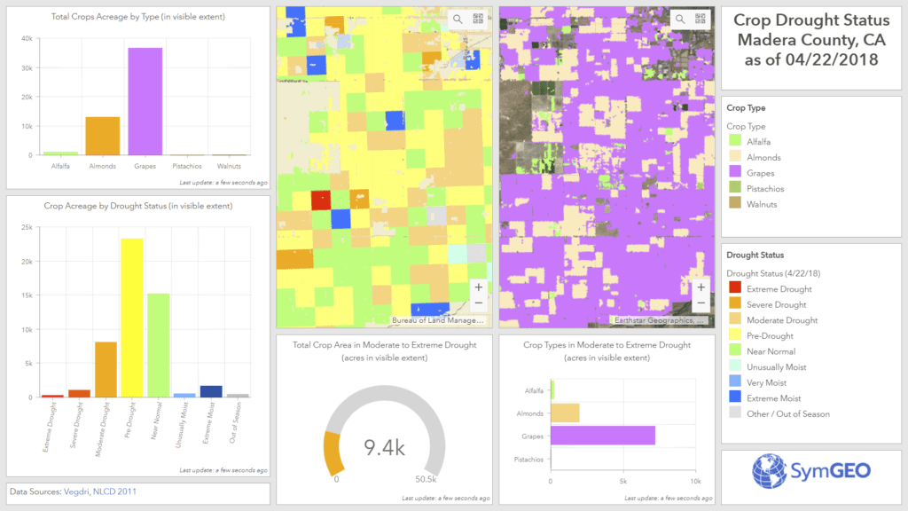
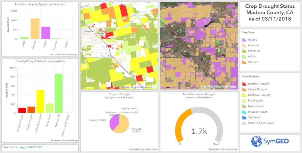
Incorporating remotely-sensed drought information is key to informed water use and allocation decisions in arid areas of the country. Help your district save time, money, and natural resources!

Read more


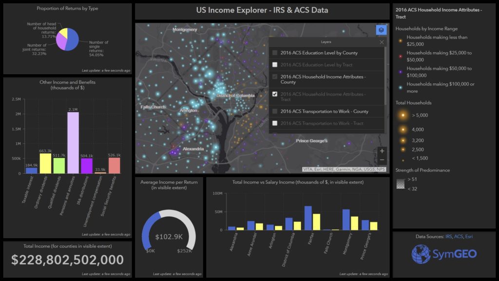
Integrating data from a number of sources such as IRS, Census, Esri, and others allows beautiful visualizations of neighborhood demographics and statistics.

Read more


Check out a selection of our dashboards here, or contact SymGEO with project ideas.

From all of us at SymGEO, enjoy the holiday season!

September News 2018

September seemed to be the month of the hurricane with Florence churning its way towards the Carolina coast. Fortunately the GIS community is always prepared and ready to help on the digital front!

esri hurricane gallery

The hurricane program at Esri is an impressive collection of data, sample applications, community-based efforts, and ideas for future development.

Read more


SymGEO used Esri Living Atlas content to produce a mobile-responsive Hurricane Tracker application showing the forecast path of the hurricane.

Read more


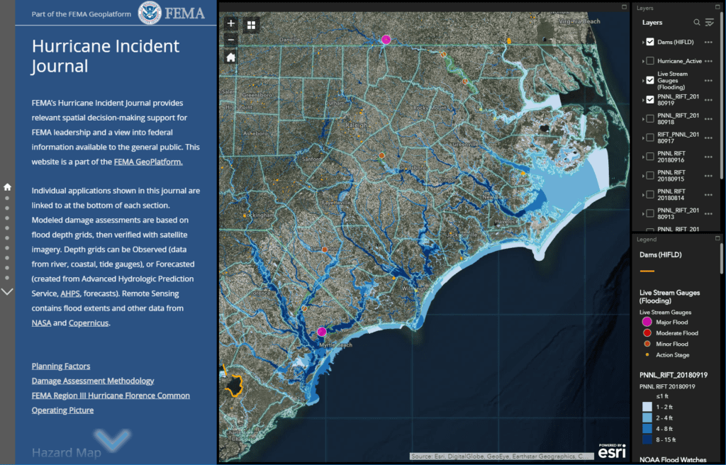
FEMA’s Hurricane Incident Journal provides relevant spatial decision-making support for FEMA leadership and a view into federal information available to the general public.

Read more


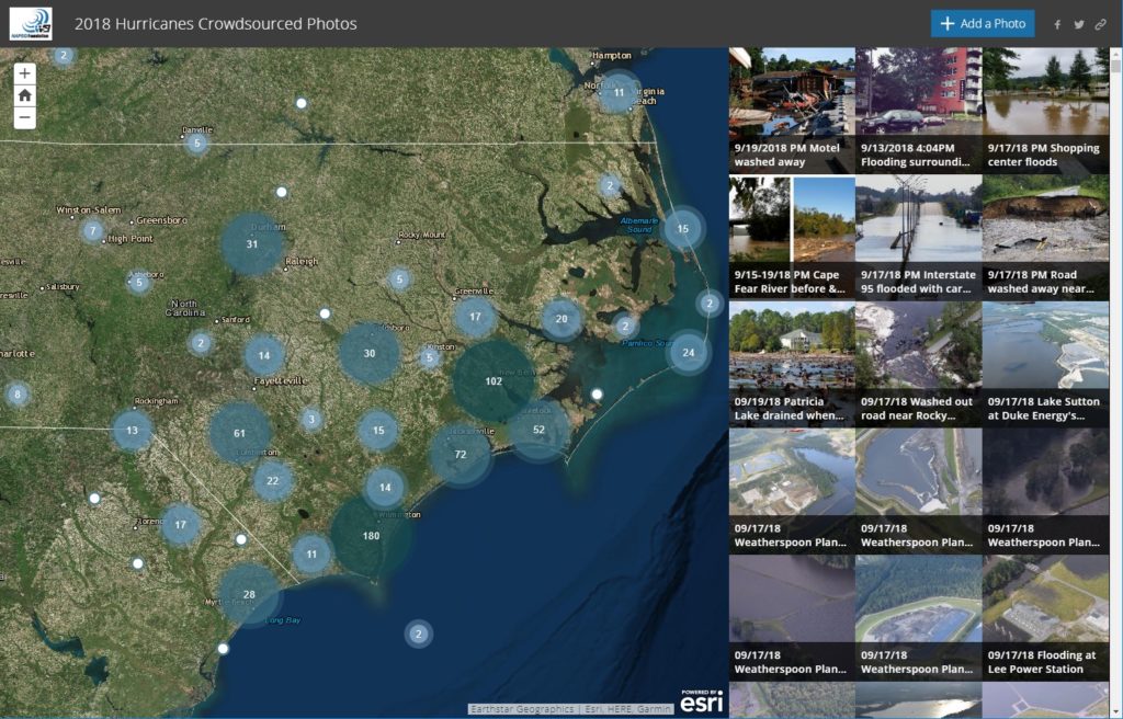
The National Alliance for Public Safety (NAPSG) and GISCorps sprang into action to produce an insightful crowd-sourced photo application to document damage and help direct relief efforts.

Read more


Have an idea for a project? Shoot us an email with project ideas or requirements as we’re here to help, and enjoy the fall season!

August News 2018

August was an exciting month at SymGEO, including commercial real estate management, Enterprise Server configuration, and even a little data processing thrown in. Read on for details!

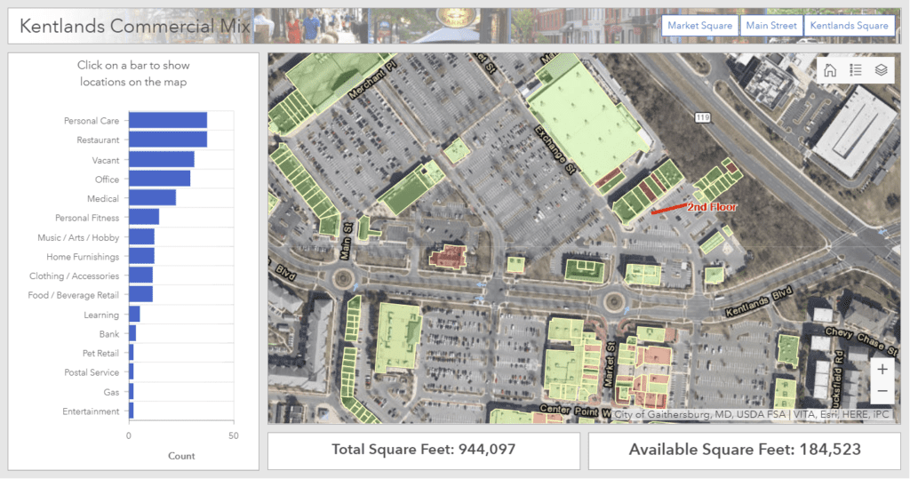
commercial property management

Keeping track of who is where, what’s coming soon, and when leases are ending can be quite a challenge when hundreds (or thousands!) of properties are involved. Fortunately, GIS is perfectly suited to this task.

Read more


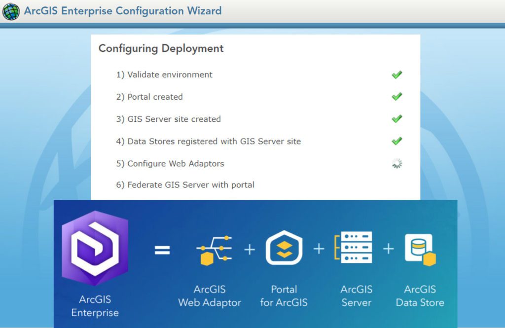
Publishing, organizing, and making data accessible on the web can be tricky business in an ever-changing technical landscape. If you’re ready to set up EnterpriseServer, or Portal, let us know as our highly trained technical staff is here to help.

Read more


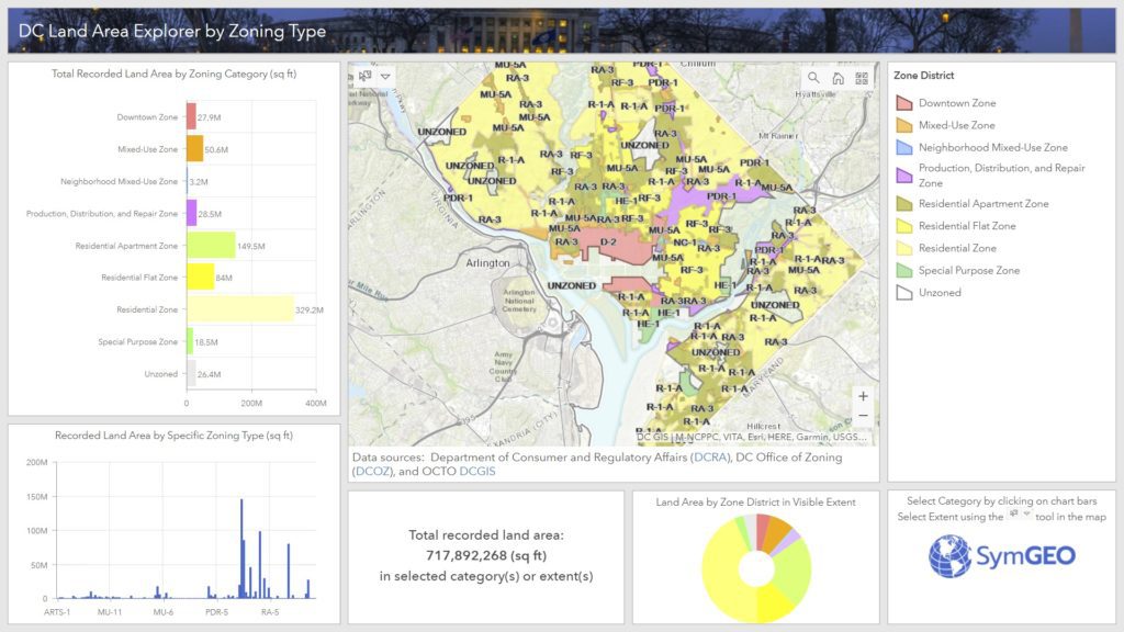
Ever wonder how much land area there is in DC by zoning type? Well, wonder no more, as we sliced and diced the data, and created the DC Land Area Explorer by Zoning Type.

Read more


Have an idea for a project? Contact SymGEO with project requirements as we’re here to help, and enjoy back-to-school season!

July News 2018

Time flies when you’re having fun! From sledding to traffic to wetlands, SymGEO was all over the map in July – read on for details.

sledding locator

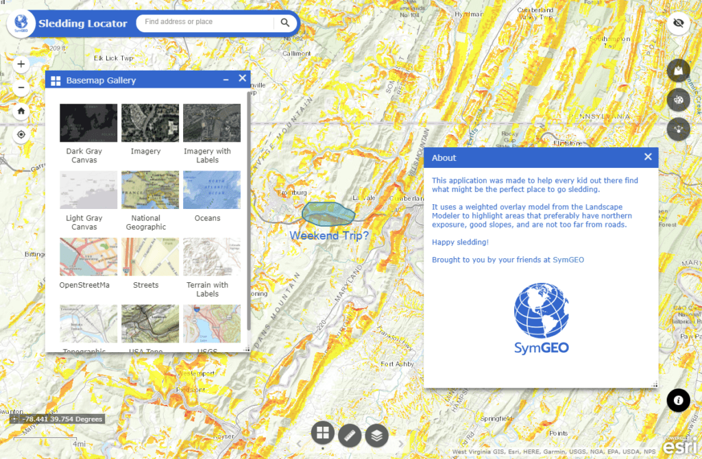
This month our thoughts turned to sledding (nobody knows why, and we’re not supposed to ask), resulting in a first-of-its-kind optimal sledding locator application. Harnessing the power of suitability modeling and Web AppBuilder, we are now ready for winter.

Read more


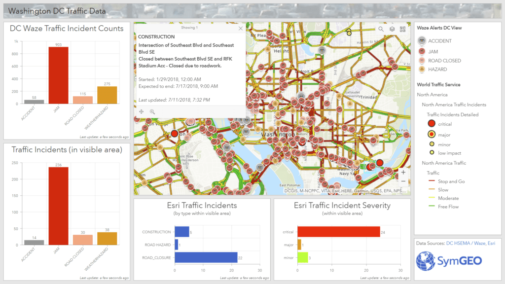
From there, we were excited by the new expanded partnership announced between Waze and Esri, so we immediately jumped on the bandwagon and built the DC Traffic Dashboard. Plan your route, ready the audio-books, and get to your happy place!

Read more


wetland remote sensing

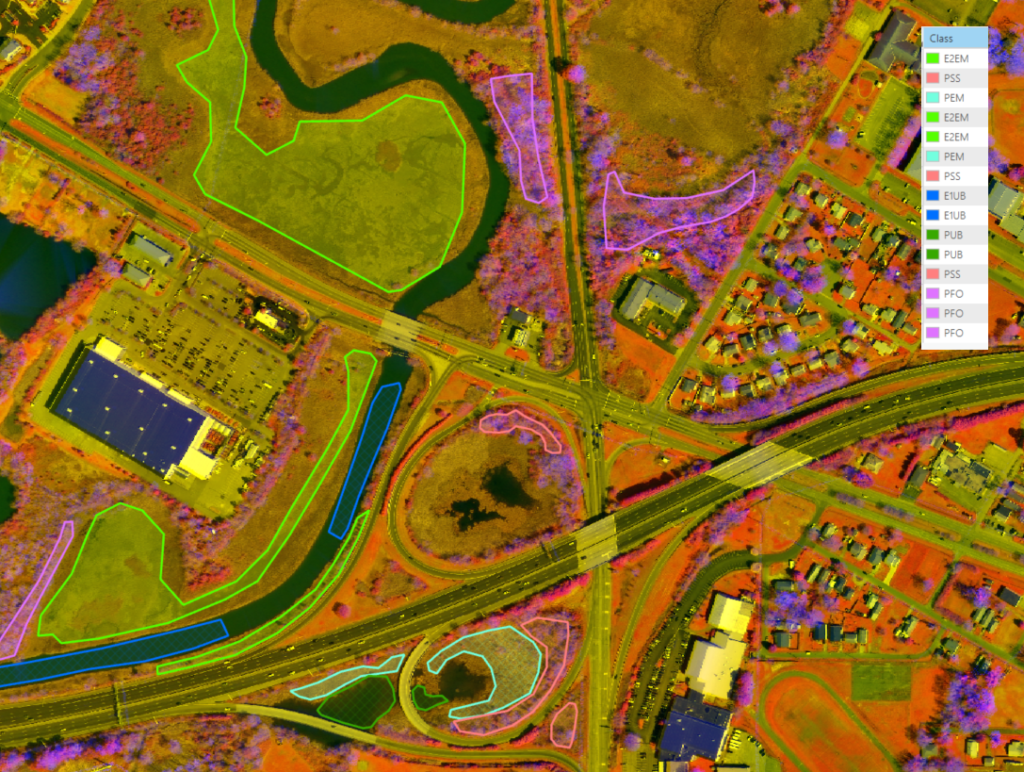
Then, in a nod to experts out-standing in their field, we wanted to give wetland delineators something to think about – the remote sensing of wetlands as a cost-effective solution to a traditionally labor-intensive process. Lots of promise, and lots of fun with our friends at the Virginia Department of Transportation (VDOT).

Read more


Have an idea for a project? Contact SymGEO with project requirements as we’re here to help, and enjoy the rest of summer!

May News 2018

SymGEO provides insightful spatial data analytics and intuitive mapping solutions. We focus on configurable, cost-effective, data-driven mapping applications.  We have an awesome new capabilities statement page that is perfect for printing and/or framing, and are currently offering a FREE consultation session, designed to explore your data requirements and solution options together.

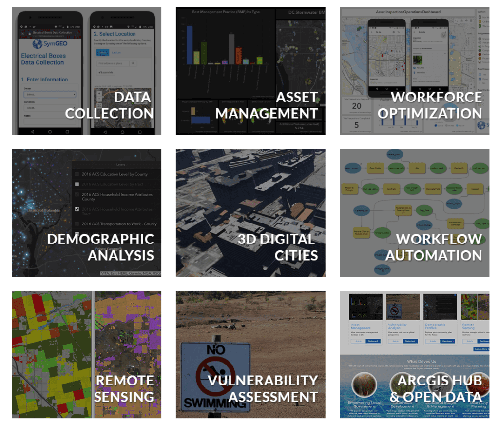
This month we got our Hub on, and experienced the power of Esri’s latest technology for ourselves. Organizing data, initiatives, applications and capabilities has brought order to our spatial world, and we can do the same for you.

Read more


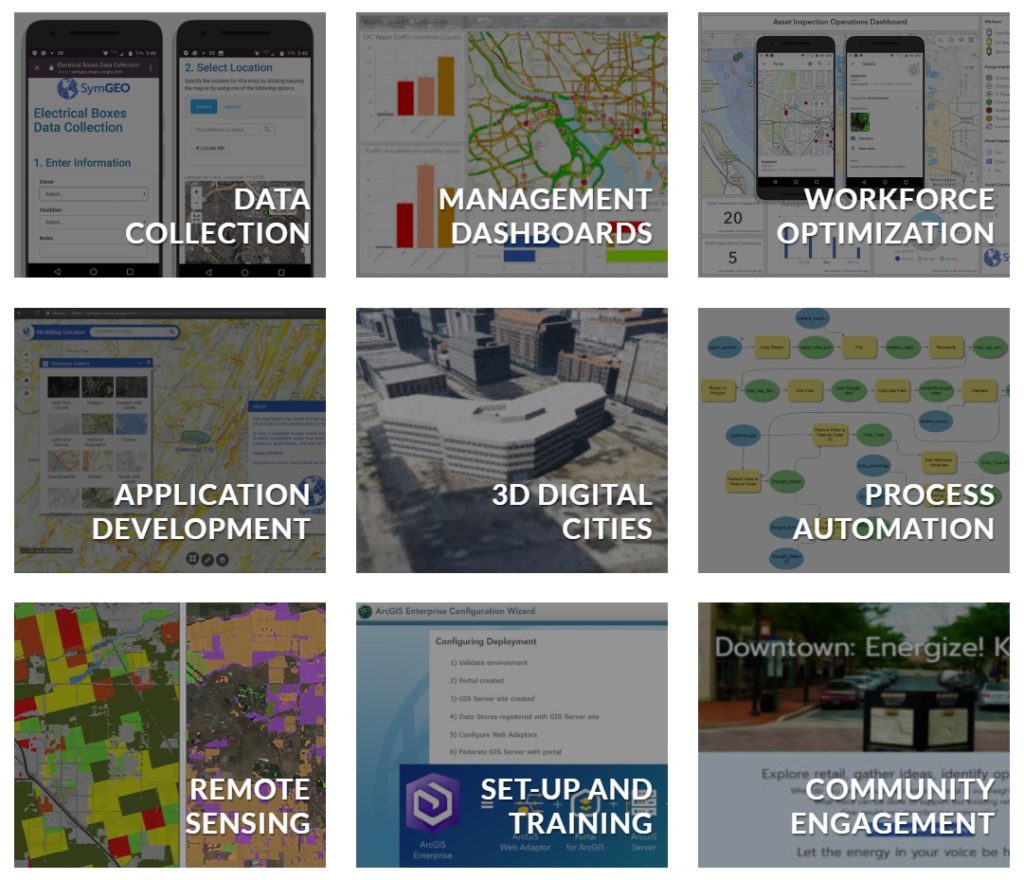
data collection

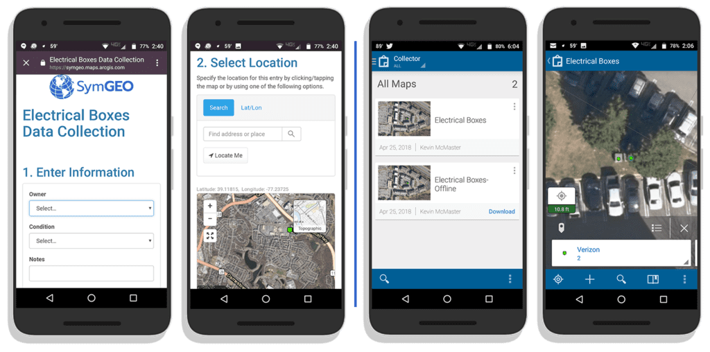
Data collection and solution integration are SymGEO specialties. When you need a fast, easy, intuitive data collection strategy, we got your backs.

Read more


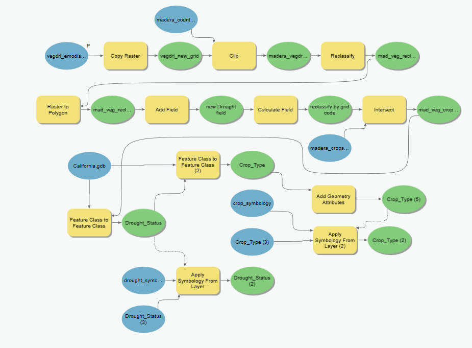
data workflow automation

Can building and optimizing automated data workflows be fun? Absolutely! Let us know what you’re trying to do, and we’ll present innovative options to make your life easier.

Read more


symgeo projects

Check out these projects (and their friends) on our newly updated projects page, and let us know if you have a project requirement with SymGEO‘s name on it.

April News 2018

Spring has sprung, and new ideas are growing left, right and center! This month SymGEO has focused on the 3D building construction process, from local buildings to city-wide development, and dove into mobile workforce management. Follow us on Twitter or LinkedIn for timely news, and let us know if you’d like to see specifics on any technology mentioned here.

building a digital city
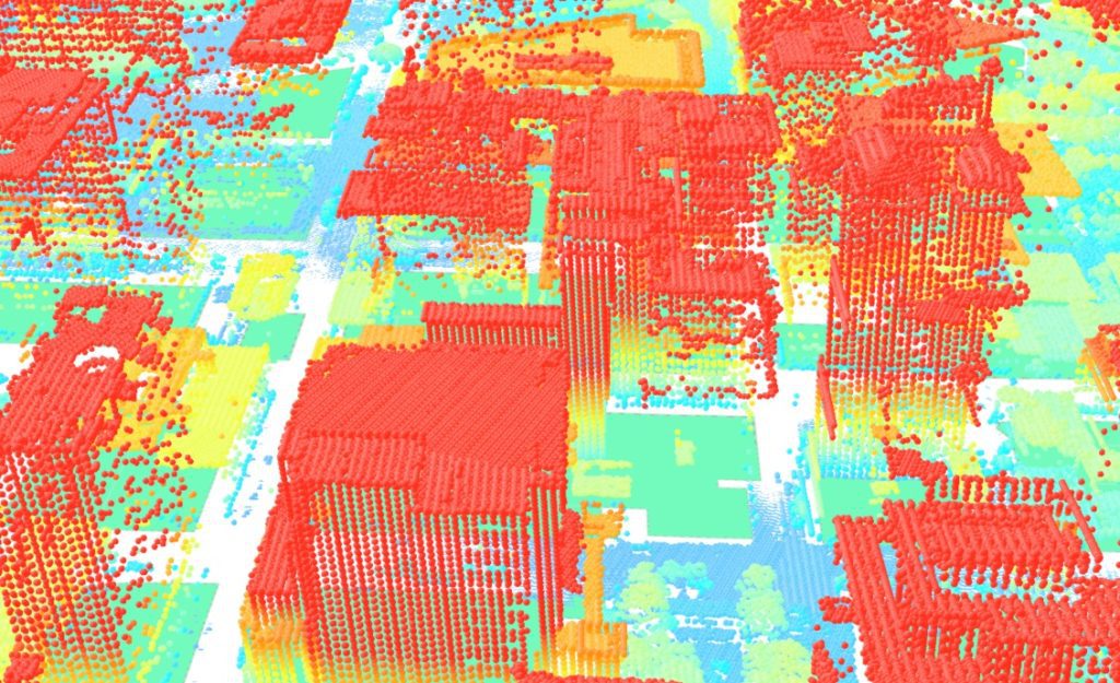
We have continued to improve upon our process for building 3D models, and scaled up production to the city level. Using LiDAR data and building footprints, digital city twinning facilitates planning and redevelopment scenarios.

Read more


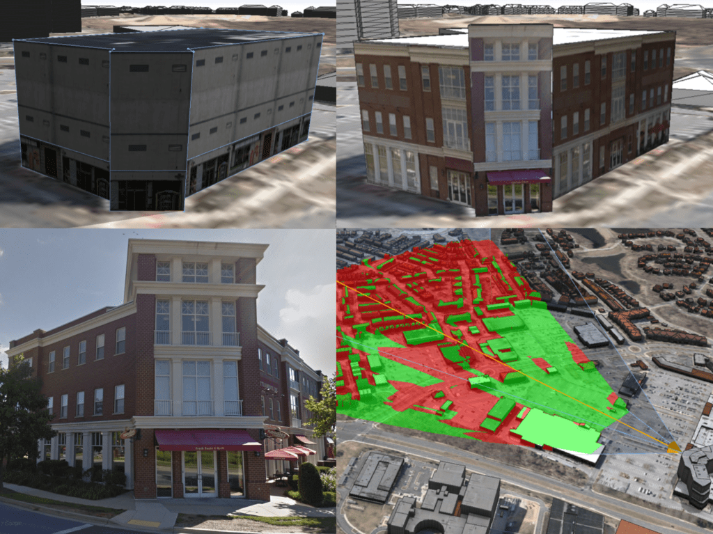
When generic building textures aren’t enough, we use ground-level photography as a “skin” for the building. This makes the buildings instantly recognizable to audiences familiar with the locations.

Read more


workforce management

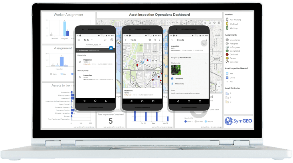
So, your people are your greatest asset. Do you know where your greatest assets are? Right now?? Mobile workforce management just got a lot easier with Esri technology.

Read more


project page

Check out these projects (and their friends) on our newly updated projects page, and let us know if you have a pet project that could use some SymGEO love.

March News 2018

It’s been an amazing second month since launch, and we’re happily rolling out project examples of our services and pushing the boundaries of technology. We were also honored to be selected for Esri’s Emerging Business Partner program, and appreciate the faith Esri has in our abilities. Follow us on Twitter or LinkedIn to stay in the know, as it’s an exciting world out there!

We have developed a state-of-the-art 3D building visualization workflow, designed to bring existing or proposed buildings to life. Fully immersive exploration options are guaranteed to add the wow-factor to your presentations.

Read more


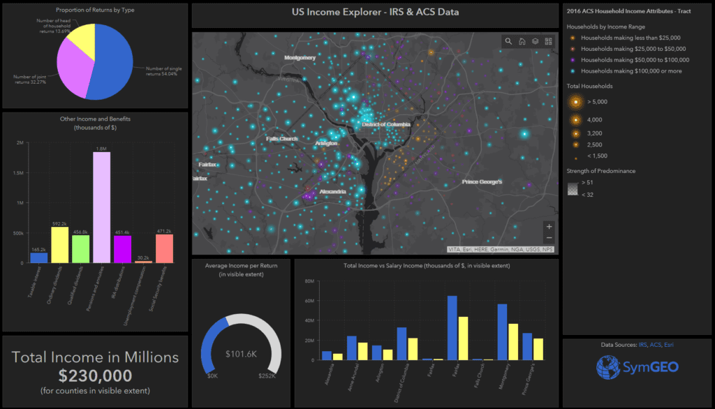
We pushed the boundaries of both cartography and dashboards with the US Income explorer, designed to show the sharp geographic divides in neighborhood area characteristics.

Read more


Drought in California impacts the $20+ billion dollar agricultural industry. We leveraged near-real time satellite-derived drought data to find out exactly which crops were at risk for an example county.

Read more


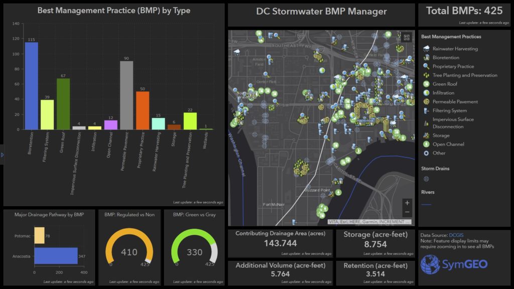
Efficient asset management is a snap when you bring the right data together with configurable application technology, as shown by our stormwater management work in Washington DC.

Read more


News for February, 2018

SymGEO News is designed to aggregate and share relevant and timely stories of geospatial data advances from around the web, and around the world. Knowledge sharing in this age of information is critical to advance the science – leading to better decisions and more insightful stories. Join us by subscribing, and share your story with our community!

News for February, 2018
SymGEO has launched a free interactive Global Water Risk Dashboard designed to help inform policy decisions around the world!

Read more


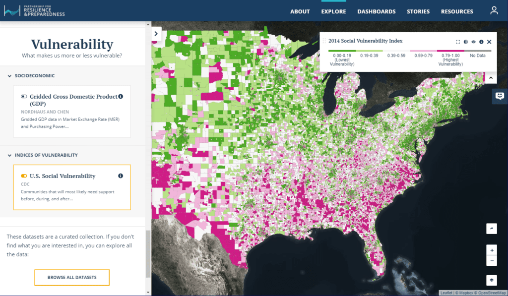
(Image from https://www.prepdata.org/)

PREPdata, an open-source platform, seeks to improve access to useful data and empower communities and businesses to better plan for and build climate resilience.

Read more


(Image courtesy of Wikimedia Commons/Ramkumar)

Water shortages cost Indian energy companies billions based on new research from Water Resources Institute.

Read more

News for January, 2018

SymGEO News is designed to aggregate and share relevant and timely stories of geospatial data advances from around the web, and around the world. Knowledge sharing in this age of information is critical to advance the science – leading to better decisions and more insightful stories. Join us by subscribing, and share your story with our community!

News for January, 2018


Image courtesy of www.jct600.co.uk

Smart Cities are embracing GIS to solve problems ranging from traffic to bad landlords using location-driven analytics and ground truthing.

Read more


Image courtesy of World Resources Institute and The Nature Conservancy

Planting trees as a business model? Studies show reforestation companies are profitable and are making a measurable positive impact on the environment.

Read more


Image courtesy of Tokyoahead at English Wikipedia

Air pollution costs businesses millions in lost revenues as consumers are more likely to stay indoors.

Read more


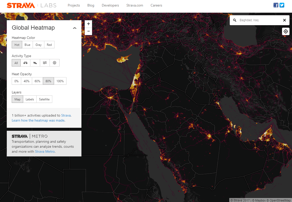
Image courtesy of Strava Labs

Strava global heatmaps show secret military bases as part of their user analytics, leading to the realization that big data visualizations may cause privacy concerns.

Read more