A CUSTOM DIGITAL SOLUTION DESIGNED TO FIT YOUR NEED.
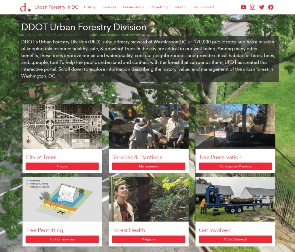
"SymGEO is a remarkably flexible and responsive company. They listen carefully to requirements and deftly blend customer vision with technological capabilities."
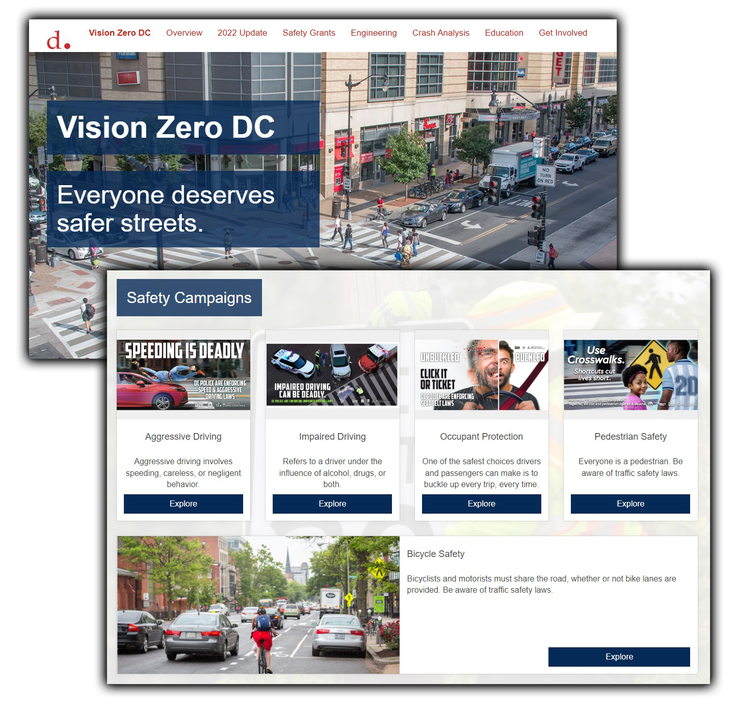
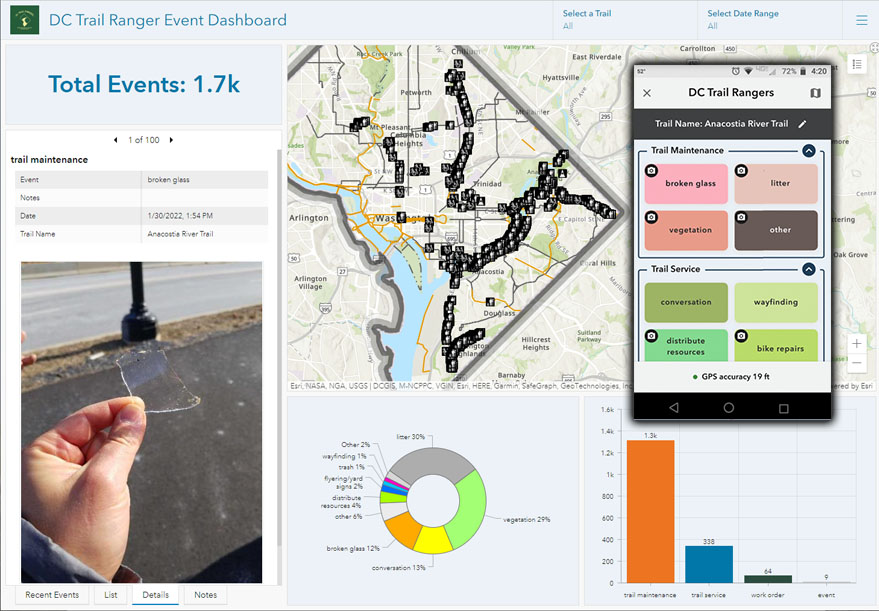
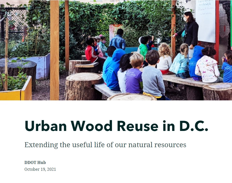
![]()
- District Department of Transportation, Urban Forestry Hub
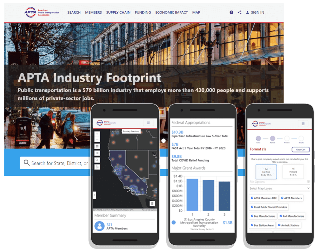
“We are happy with the results of our partnership with SymGEO. They produced a website that equals our ambition and stature as an association.”
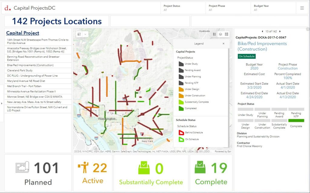
![]()
– American Public Transportation Association, APTA Industry Footprint
"This (mapping solution) is superb and exactly what the client needed and what I was imagining."
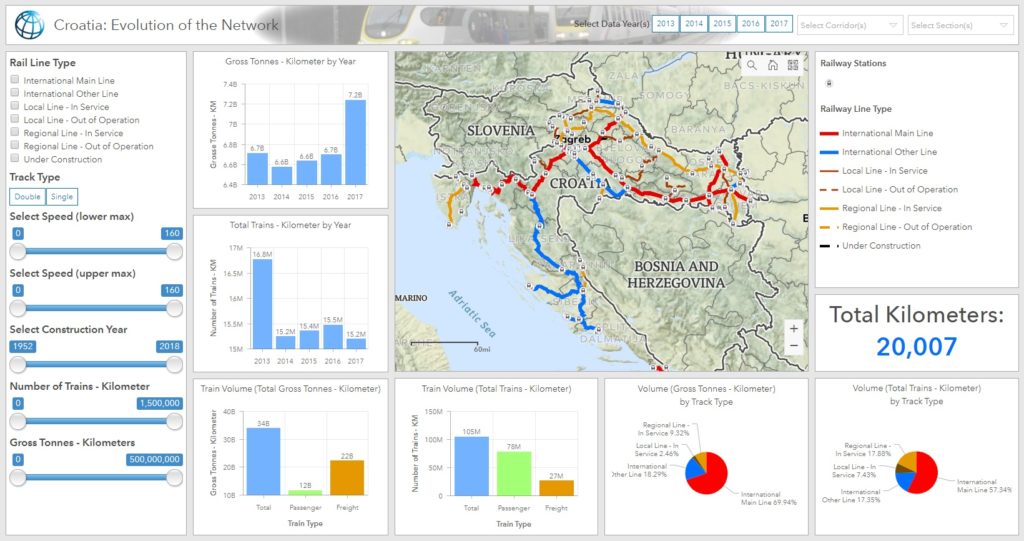
![]() - The World Bank Group, Croatian Rail Dashboard
- The World Bank Group, Croatian Rail Dashboard
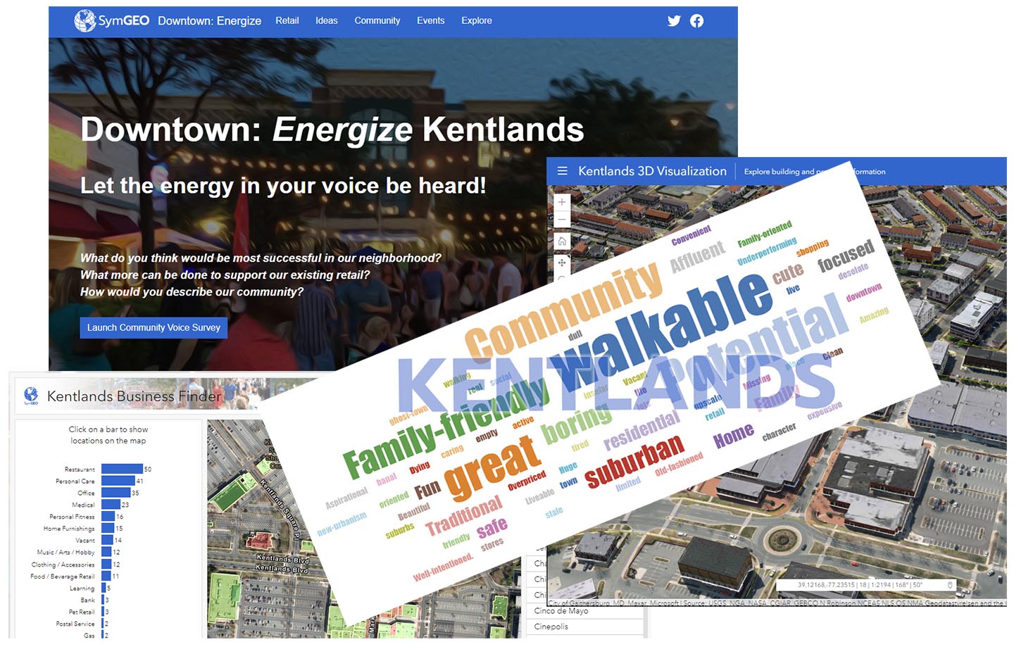
"Downtown Energize! is an innovative digital tool that is fun, easy to use, and flexible enough to accept updates and even track current events."
![]() - Local Business Owner, Downtown Energize! Kentlands
- Local Business Owner, Downtown Energize! Kentlands
Every client requirement has a unique solution.
Schedule your free consultation today.