DC State Forest Action Plan

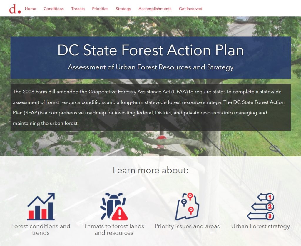
The District Department of Transportation (DDOT)’s Urban Forestry Division (UFD) is the primary steward of Washington DC’s 170,000+ public trees and has a mission of keeping this resource healthy, safe, and growing. Among many other benefits, urban trees improve the air and water quality, cool the neighborhoods, and provide critical habitat for birds, bees, and urban wildlife. As part of their long-term statewide forest resource strategy, the UFD has created the DC State Forest Action Plan (SFAP). This plan is a comprehensive roadmap for investing federal, District, and private resources into managing and maintaining the urban forest.

To help highlight the achievements and findings of the plan, SymGEO created the DC SFAP Hub site, full of condensed information from the full report.

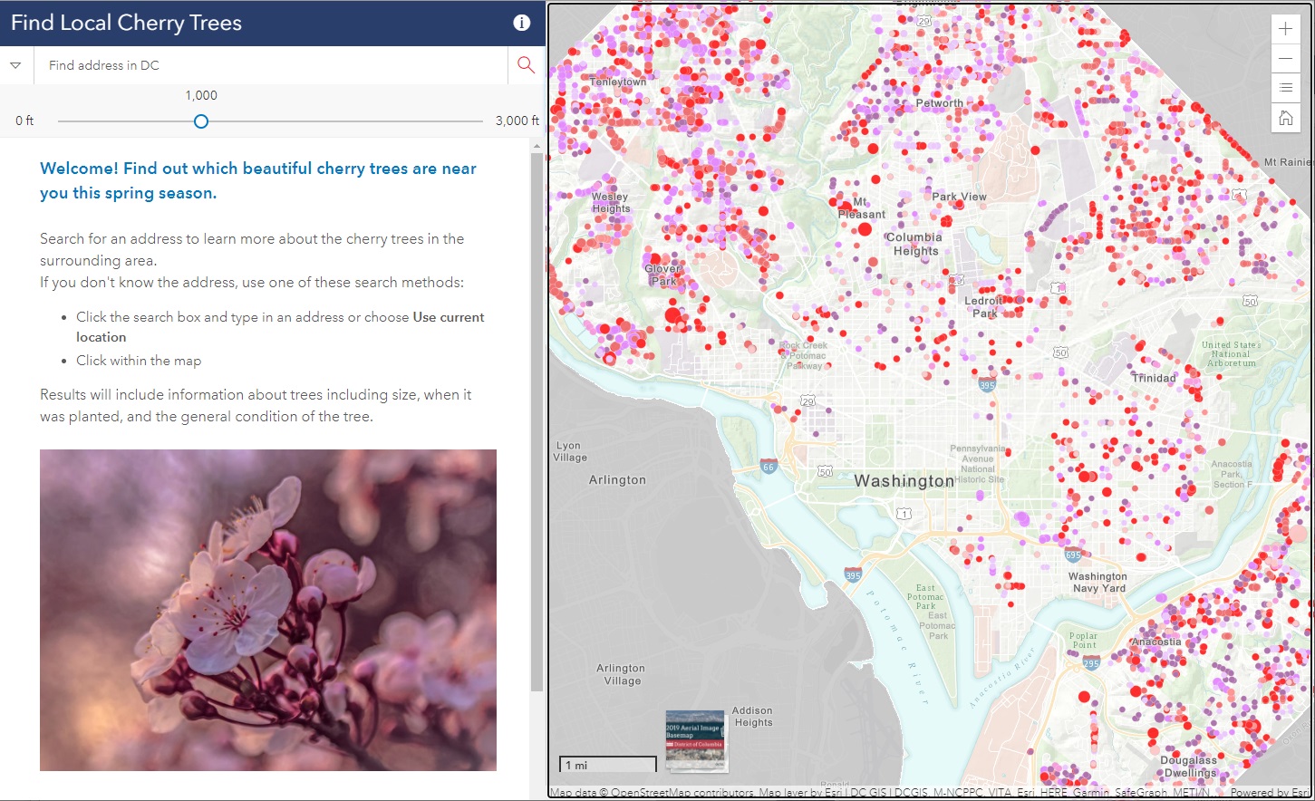
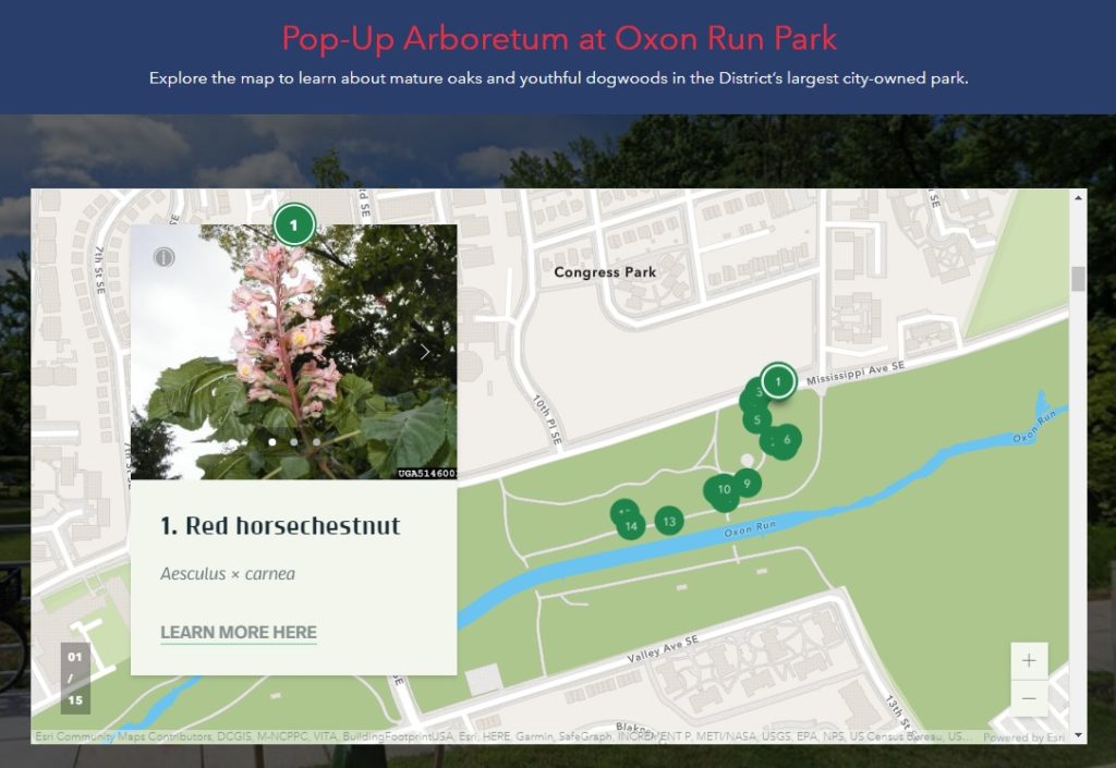
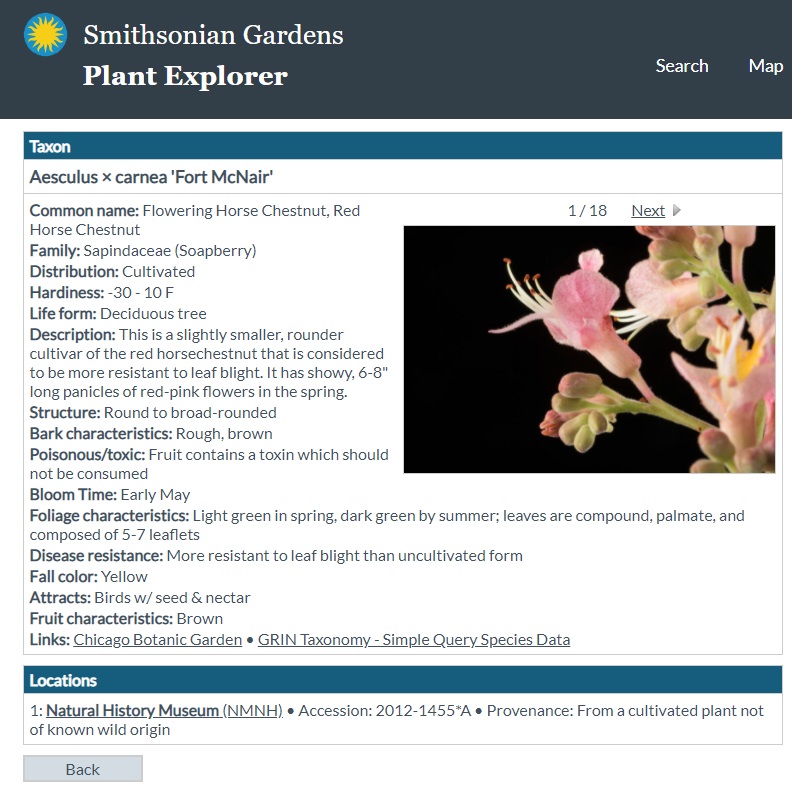
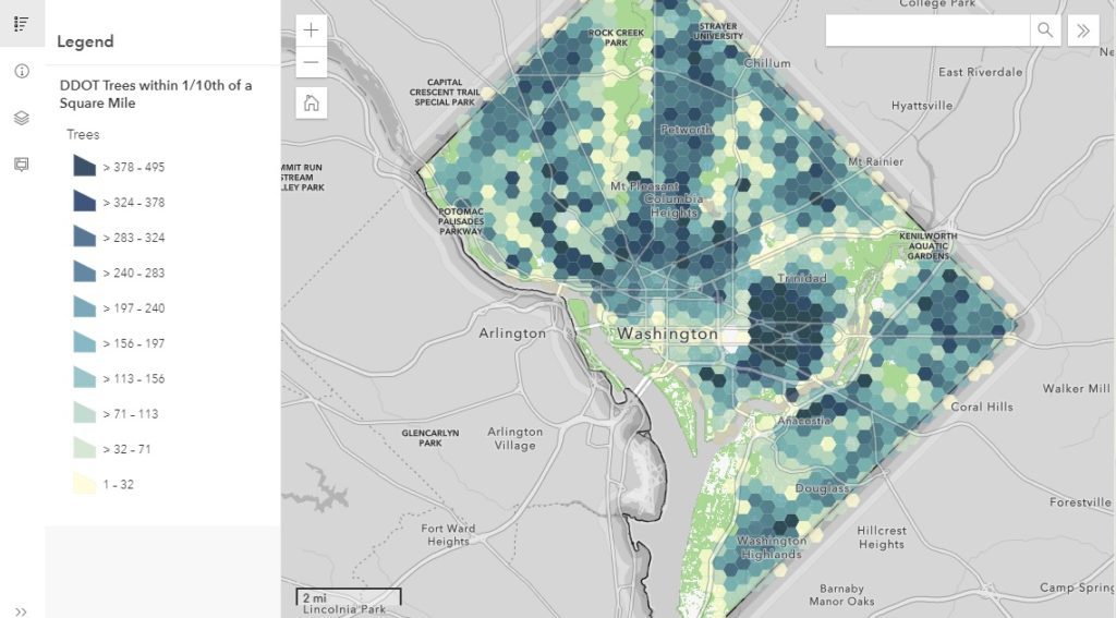
The DC SFAP Hub site integrates numerous data sets, Dashboards, StoryMaps, and other helpful visualizations to support the findings of the report and long-term strategy.

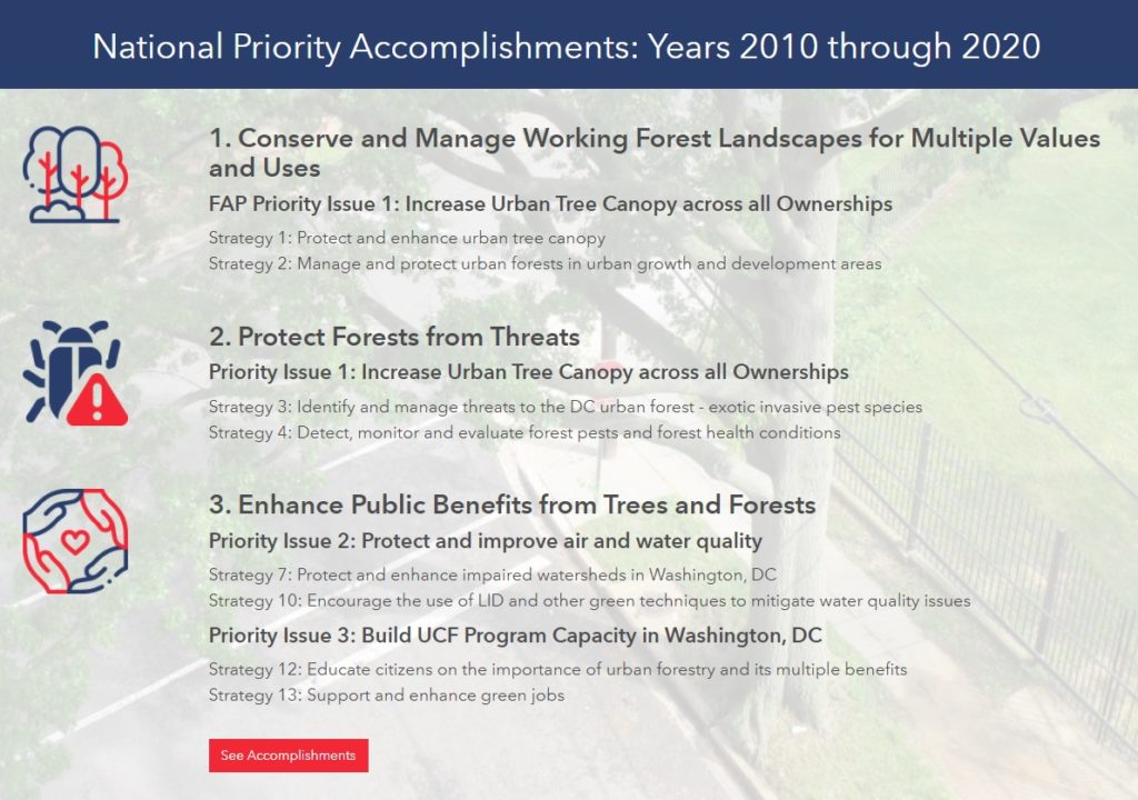
Key accomplishments from the last ten years are presented with links to further information and full documentation.

Explore the DC SFAP Hub site to learn more about D.C.’s forest conditions and trends, threats to forest lands and resources, priority issues and areas, and the long-term urban forest strategy.

Talk to SymGEO industry experts today if your agency or organization is interested in community engagement with the power of Esri’s ArcGIS Hub, Dashboards, or ArcGIS StoryMaps –  we are here to help!

DC Cherry Tree Viewer

Did you know that there are almost 10,000 cherry trees outside of the tidal basin to see throughout D.C.? SymGEO was honored to help DDOT build the DC Local Cherry Tree Finder leveraging the Urban Forestry Division‘s tree inventory and ArcGIS Online‘s configurable applications to quickly assemble and launch in time for peak blooming.

If you missed it this year, don’t worry, there’s always next spring season!

Talk to our industry experts today if your agency or organization is interested in community engagement with the power of Esri’s ArcGIS mapping solutions – SymGEO is here to help!

Pop-up Arboretum

An arboretum is a place where trees, shrubs, and other plants are grown for scientific and educational purposes. A park typically has trees, shrubs, and other plants for the enjoyment of families and friends. Why not have an arboretum in a park? Genius! Check out the first “pop-up arboretum” at Oxon Run Park in Ward 8 by the District Department of Transportation’s (DDOT) Urban Forestry Division. SymGEO is pleased to help launch the Pop-Up Arboretum website with all the specifics of what amazing things can be found at this natural outdoor exhibit.

The site is built using ArcGIS Hub technology and features an ArcGIS StoryMap designed to help guide people on their outdoor educational adventure. The site also links to scientific information about each tree species provided by the Smithsonian Institute’s Plant Explorer.

Signs are posted on or near the trees in English and Spanish with QR Codes that link back to the Pop-Up Arboretum website for further information. Be sure to enjoy our natural environment while learning all about the trees at Oxon Run Park!

Talk to our industry experts today if your agency or organization is interested in community engagement with the power of Esri’s ArcGIS Hub or ArcGIS StoryMaps – SymGEO is here to help!