SymGEO State and Local Government Specialty

SymGEO is pleased to announce we have been awarded Esri’s State and Local Government Specialty designation. This award recognizes SymGEO’s expertise in state and local government, implementation, and delivery of services that help customers succeed. This specialty is one of Esri’s newest specialties, and SymGEO is pleased to join four other prestigious partners who have obtained this designation.

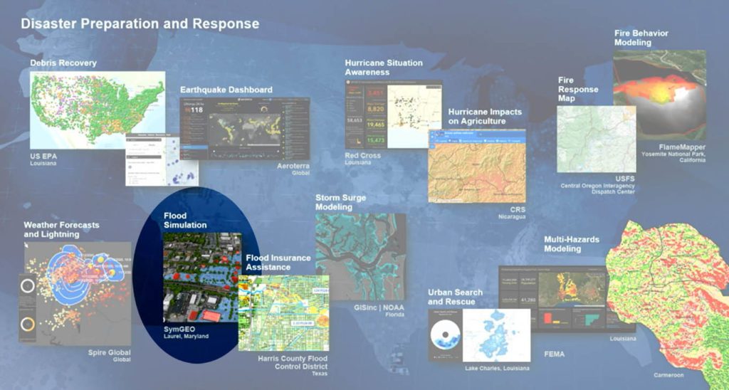
SymGEO has been fortunate to work with great government clients on projects that have now appeared at Esri plenary presentations around the country, with the most recent being at the Esri Federal GIS Conference 2021. Our web GIS work with the District Department of Transportation and our 3D flood visualization work both made an appearance on the main stage. We are really thankful for the opportunity and trust that Esri has placed in our skills and services with the State and Local Government Specialty designation, and we look forward to helping our client partners implement Esri technology for years to come.

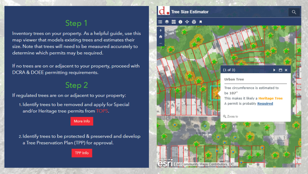
DDOT Tree Permitting ArcGIS Hub page development

3D Flood Visualization technology for Laurel, MD.

To learn more about these projects or any of our services, contact us to start a conversation – SymGEO is a certified Esri specialist and is here to help.

Pop-up Arboretum

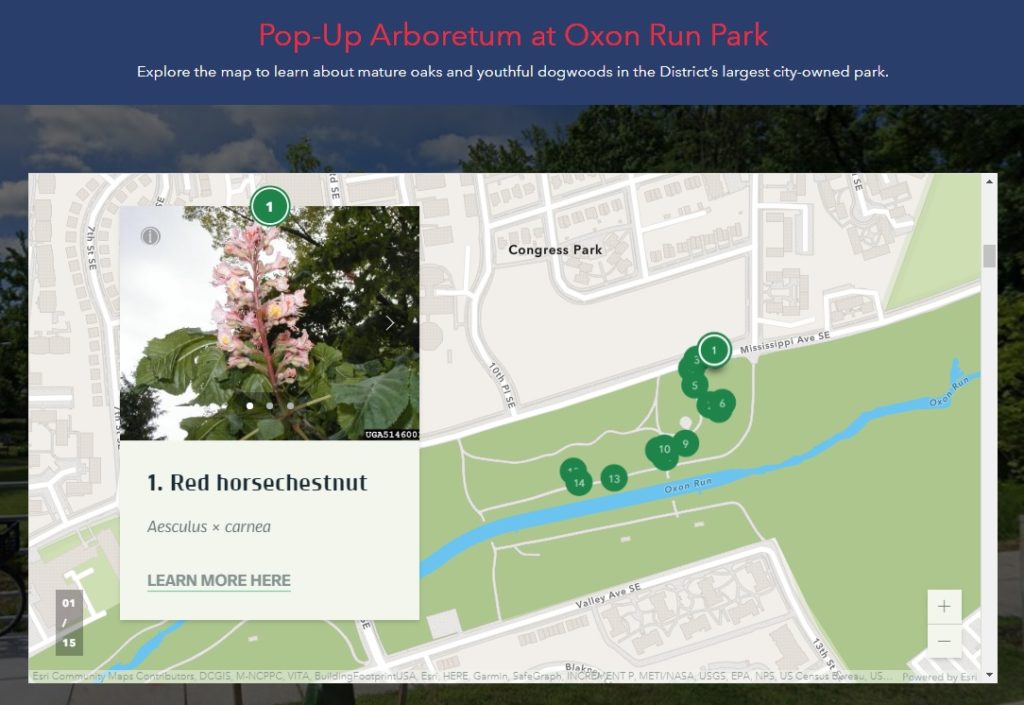
An arboretum is a place where trees, shrubs, and other plants are grown for scientific and educational purposes. A park typically has trees, shrubs, and other plants for the enjoyment of families and friends. Why not have an arboretum in a park? Genius! Check out the first “pop-up arboretum” at Oxon Run Park in Ward 8 by the District Department of Transportation’s (DDOT) Urban Forestry Division. SymGEO is pleased to help launch the Pop-Up Arboretum website with all the specifics of what amazing things can be found at this natural outdoor exhibit.

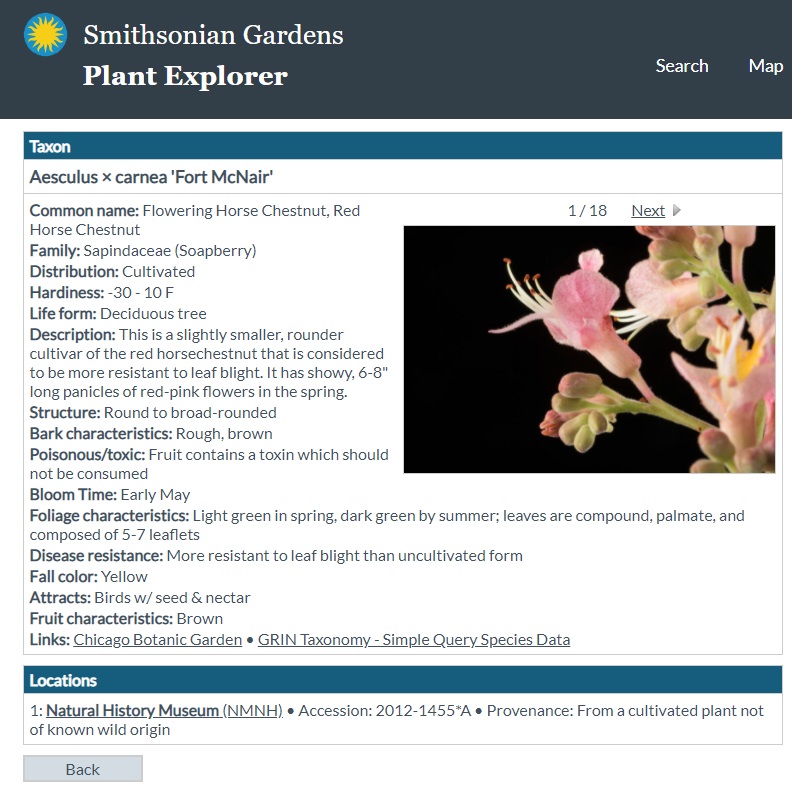
The site is built using ArcGIS Hub technology and features an ArcGIS StoryMap designed to help guide people on their outdoor educational adventure. The site also links to scientific information about each tree species provided by the Smithsonian Institute’s Plant Explorer.

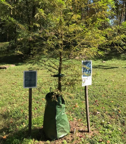
Signs are posted on or near the trees in English and Spanish with QR Codes that link back to the Pop-Up Arboretum website for further information. Be sure to enjoy our natural environment while learning all about the trees at Oxon Run Park!

Talk to our industry experts today if your agency or organization is interested in community engagement with the power of Esri’s ArcGIS Hub or ArcGIS StoryMaps – SymGEO is here to help!

Tree Permitting

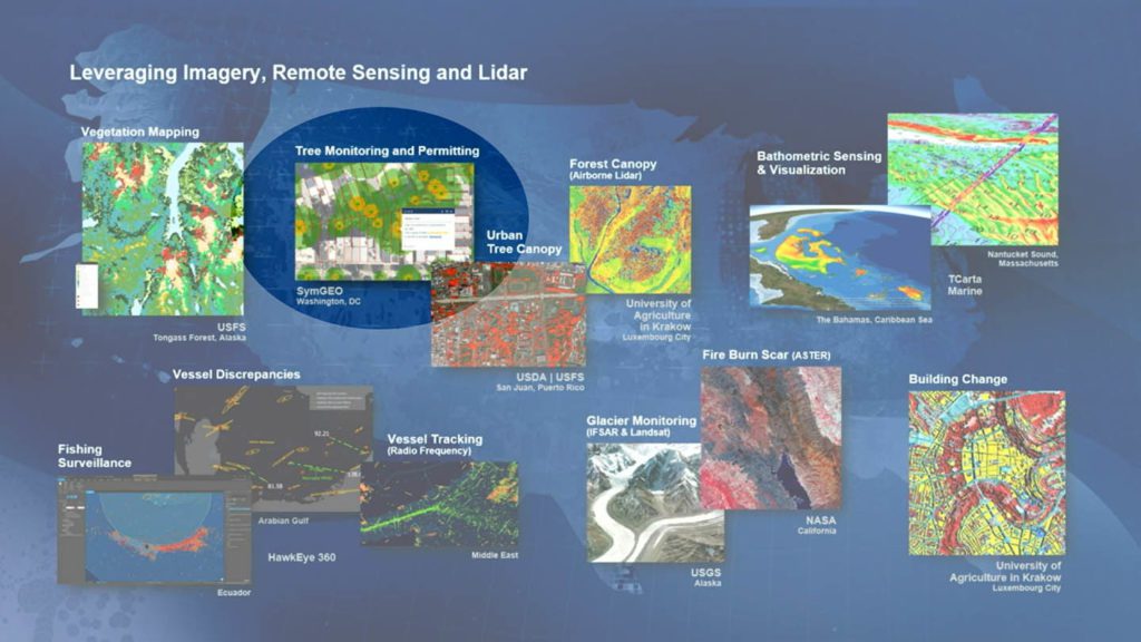
Did you know that any Washington DC resident or contractor who wishes to plant, prune, or remove a tree within the public right of way must first obtain permission from the District Department of Transportation (DDOT) and the Urban Forestry Division? However, knowing when, where, and how to get the right permit for tree work in DC can be a complicated process. Fortunately, DDOT has a new resource available to make it easy! Check out the Tree Permitting Hub site to answer all tree permitting questions.


SymGEO built the Tree Permitting site using ArcGIS Hub technology, which leverages ArcGIS Online mapping and graphic examples to help explain what type of permit is needed based on tree location, property boundaries, and tree size. The site also explains the benefits of the Income Contingent Hazardous Tree Mitigation Program that provides assistance with the removal of a hazardous tree on an owner’s private property.

As an example of “good to know” information, Washington D.C. is unique in that it has dedicated park space along most streets. This “parking” area is generally used for landscaping, retaining walls, trees, and other greenery. Just like on private land, all landscape elements (including trees) in this parking area are the responsibility of the homeowner to maintain. On the other hand, all trees located in the public “sidewalk” area are the responsibility of the city to maintain. However, these trees may be negatively impacted by development or construction projects and need to be considered before projects begin.

Talk to our industry experts today if your agency or organization is interested in community engagement with the power of Esri’s ArcGIS Hub or mapping with ArcGIS Online – SymGEO is here to help!

One Main Street Initiative

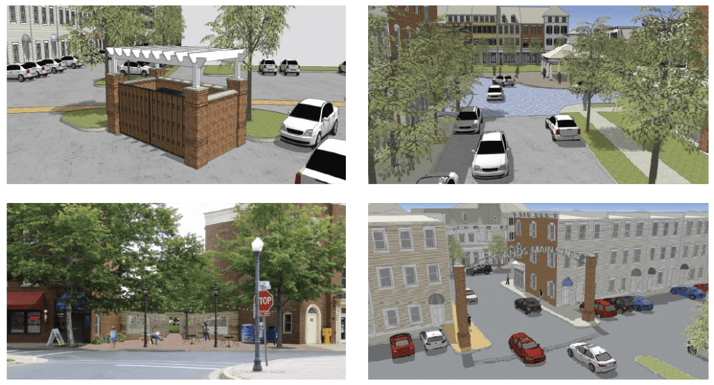
SymGEO is pleased to launch the One Main Street Initiative website produced in collaboration with our local commercial development volunteer committee. This website is powered by ArcGIS Hub technology and is designed to engage business owners and residents in the transformation of the Main Street of Kentlands into a vibrant, family-friendly, retail destination. This was accomplished by summarizing the key findings of a detailed local study conducted by Live Work Learn Play that charted a path forward to energize the Main street through a combination of events, physical improvements, dedicated leadership, and community involvement.

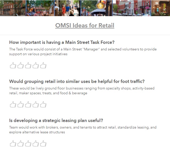
Each key component of the study was summarized and shared using a combination of text and graphics to facilitate community understanding, discussion, and evaluation.

After presenting the key findings, ArcGIS Survey123 was used to gauge public reaction to the importance of each component.

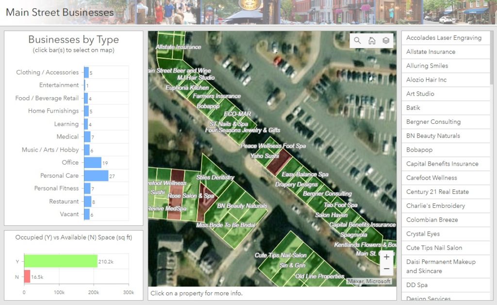
Finally, ArcGIS Dashboards was leveraged to create and share a helpful Main Street Explorer tool (desktop or mobile) for residents to see which businesses are already on Main street and where opportunities for new businesses are located.

Talk to our industry experts today if your community is interested in harnessing the power of Esri’s ArcGIS Hub to share and amplify your development plans – SymGEO is here to help!

COVID-19 Honduras

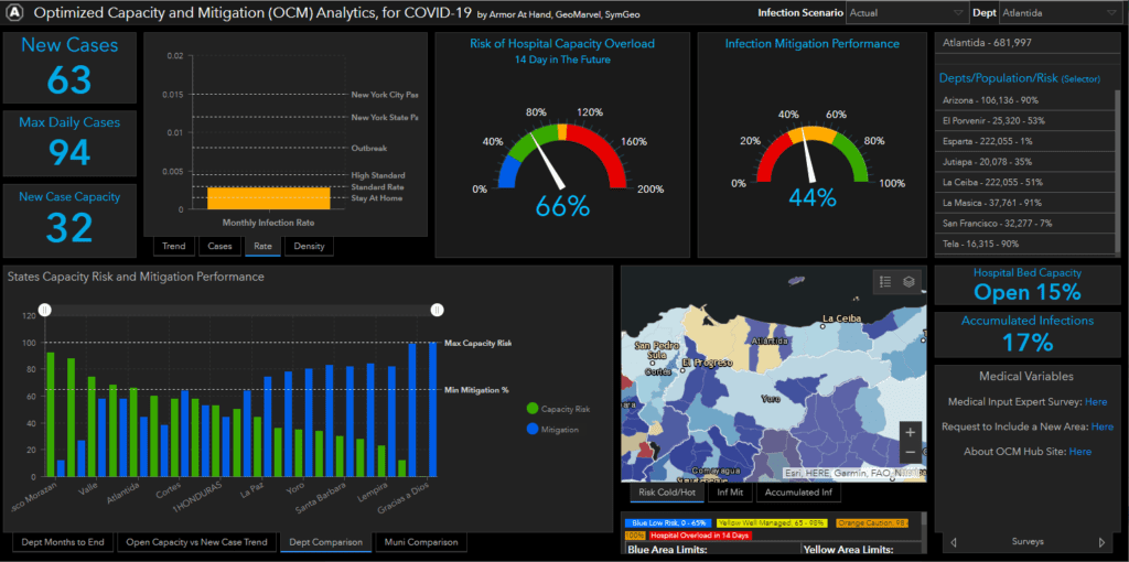
When our collaborative partners at Armor at Hand asked us if we were willing to continue our pro-bono work to fight the devastating effects of COVID-19 and help the people of Honduras, we didn’t hesitate. The result of this international work can now be seen in the Optimized Capacity and Mitigation (OCM) Honduras Dashboard.

This dashboard leverages data specific to Honduras and is a variant of the US version. This required significant updates to the modeling process and data files as well as a reconfiguration of the dashboard to reference the new data schemas. ArcGIS Online Assistant was used to facilitate the substitution of ArcGIS web maps and data services, and a new python script was developed to keep the Honduras data current.

For more information about the data model developed by Armor at Hand that powers the dashboard, check out the OCM Hub page, OCM whitepaper, or OCM ArcGIS Marketplace listing.

Talk to our industry experts today to help you leverage your spatial data with an ArcGIS Dashboard, ArcGIS Hub site, or the ModelBuilder process – SymGEO is here to help!

Tree Preservation

Did you know that trees are so important to Washington DC that they are protected by the Urban Forest Preservation Act and the Tree Canopy Protection Act? This means that before performing any excavation or construction activity on private property, it is important to consider any potential impacts to the trees on site. To facilitate this process, SymGEO is proud to help DDOT launch a new resource, the Tree Preservation Hub site, for property owners and construction companies to identify which trees need to be protected and how to best take care of them during home renovations or new construction projects.

tree preservation hub site

Built using ArcGIS Hub technology, this site leverages ArcGIS Online mapping and graphic examples to help explain what type of permit or protection plan is needed based on estimated tree size. Tree sizes were estimated using LiDAR processing, which in turn is used to estimate the critical root zone and structural root zones that need to be protected during construction. Modeling several hundred thousand trees at the same time has its challenges; however, ArcGIS Pro, ArcGIS Enterprise, Arcade expressions, and hosted image services were used to efficiently capture and share the modeling results.

Talk to our industry experts today if your agency or organization is interested in community engagement with the power of Esri’s ArcGIS Hub or data processing with ArcGIS Pro – SymGEO is here to help!

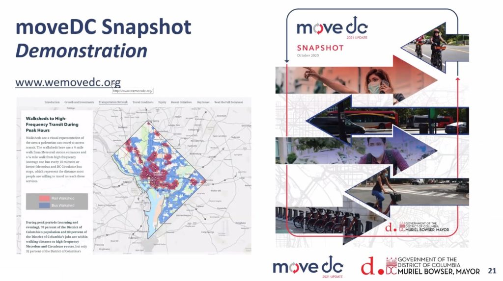
MoveDC Snapshot StoryMap

The District Department of Transportation (DDOT) has launched moveDC 2021, the long-range multi-modal transportation plan for Washington DC. As part of this launch, DDOT held Virtual Townhall meetings to discuss the transportation network’s existing conditions within the District and solicit resident input on DDOT’s goals and policies.

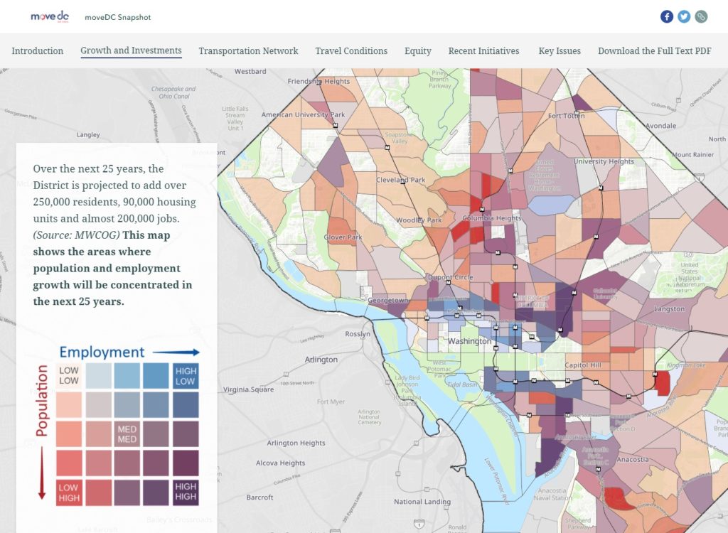
We were very excited to see our moveDC Snapshot StoryMap featured prominently during the Townhall meetings! Produced in partnership between SymGEO, Kimley-Horn, Foursquare ITP, and DDOT, this dynamic, interactive, and engaging method of presentation was perfect to capture the energy and data that has gone into moveDC 2021.

“Wow, this looks so good in StoryMap form! I love it!”

– DDOT Project Manager

We used the sidecar functionality of the latest ArcGIS StoryMap framework as a key component to deliver both guided, instructional narrative and interactive mapping at the same time. Mapping symbology was set in the ArcGIS Online web maps while complex legends were imported as images to facilitate visual interpretation of the data.

Talk to our industry experts today if your agency or organization is interested in community engagement with the power of Esri’s ArcGIS StoryMap technology – SymGEO is here to help!

Arbor Day

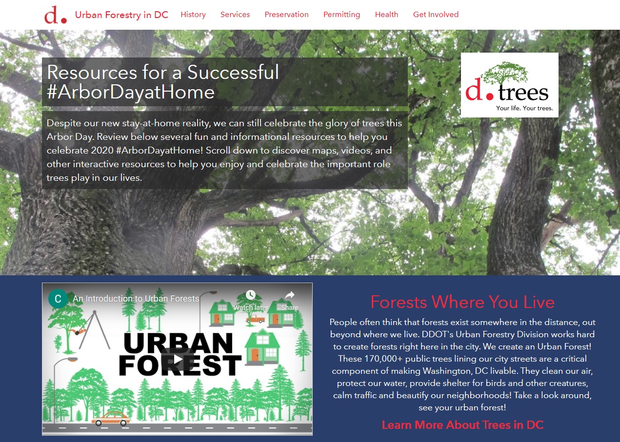
“Every day is Arbor Day in the City of Trees!” – these wise words from Dr. Kasey Yturralde, the Forest Health and Community Outreach Specialist at DDOT’s Urban Forest Division (UFD), are a great indicator of the passion and excitement possessed by the entire UFD team keeping our city green and beautiful.

With that in mind, SymGEO is pleased to announce a brand new interactive Arbor Day at Home resource for communities and individuals who share the same passion for our neighborhood trees. This dynamic website, built with ArcGIS Hub technology, showcases a number of best-practices when planting or caring for trees, as well as fun activities for the whole family in identifying local tree varieties.

Talk to our industry experts today if your agency or organization is interested in community engagement with the power of Esri’s ArcGIS Hub – SymGEO is here to help!

COVID-19 Mitigation Analytics

Returning to “normal” after (or during) a global pandemic is a complicated prospect. Finding the right balance between the potential rate of infection based on social distancing scenarios versus hospital capacity to handle projected cases requires advanced spatial modeling and analytics. Needless to say, when SymGEO was asked to help our national recovery effort by our respected peers in the industry, GeoMarvel and Armor at Hand, we were happy to do as much as possible to assist.

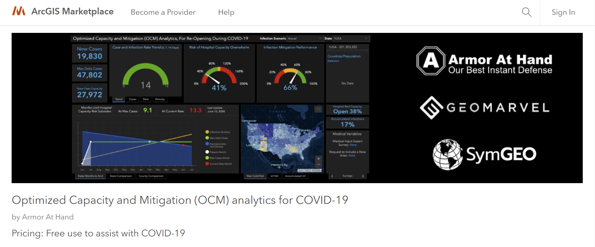
The result of this collaboration is the Optimized Capacity and Mitigation (OCM) Analytics Dashboard, free for use in the ArcGIS Marketplace to assist with COVID-19 mitigation efforts. This dashboard is designed to use current hospital capacity data, infection rate scenarios based on demonstrated or projected epidemiology statistics, and peer-reviewed variable modeling methods. The history of this project is described on the OCM ArcGIS Hub site and summarized in an informative OCM whitepaper.

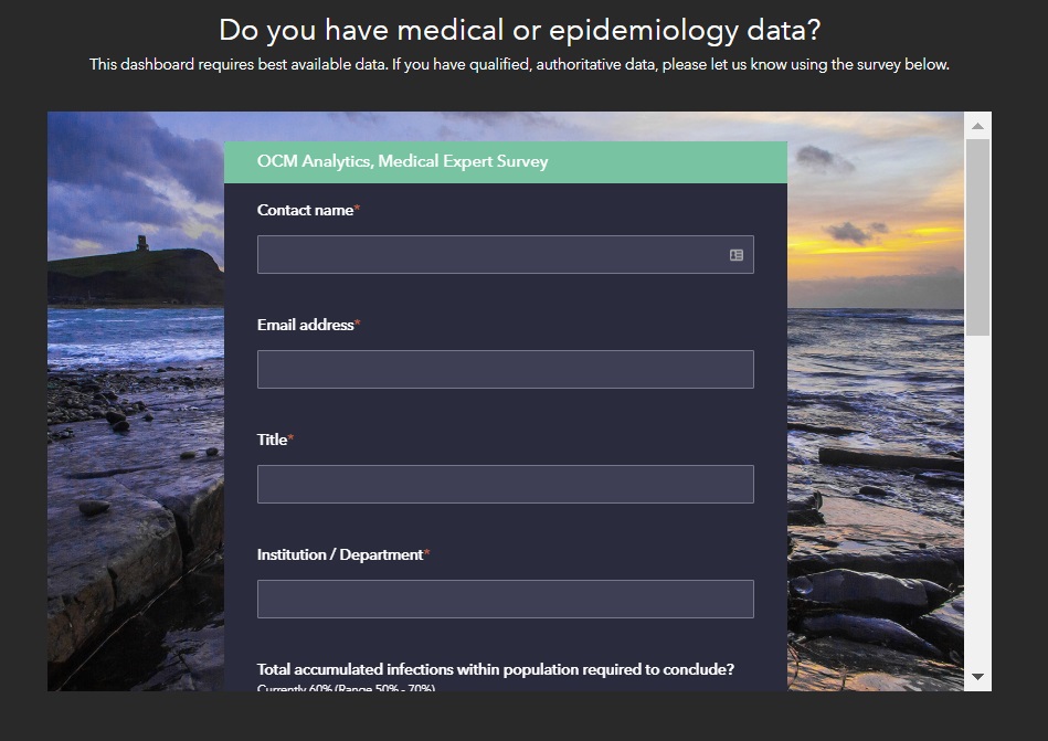
As modeling scenarios become more sophisticated and our understanding of infection rates is improved, this information can be used to augment the dashboard results. This information can be submitted by subject matter experts through an integrated survey on the ArcGIS Hub site.

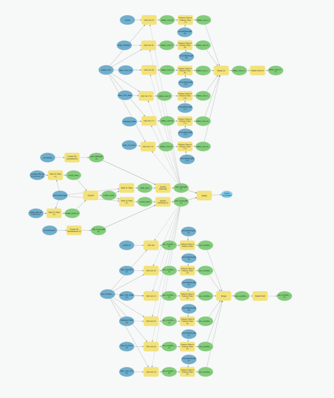
ArcGIS Pro ModelBuilder was used to facilitate and standardize the modeling updates and data tables used by the dashboard. The model was then converted into a Python script, designed to be run as needed to keep the data current and informative.

Check out the OCM Dashboard, OCM Hub page, or OCM ArcGIS Marketplace listing to learn all about this project and let us know if SymGEO can help you leverage your spatial data with an ArcGIS Dashboard, ArcGIS Hub site, or the ModelBuilder process.

Now in the ArcGIS Marketplace

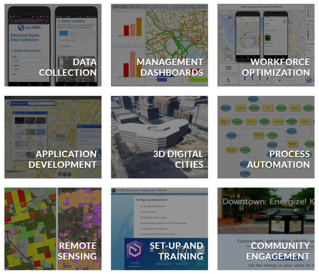
SymGEO is thrilled to have our services and solutions listed in the ArcGIS Marketplace, the top destination for users to search, discover, and acquire apps, content, solutions, and professional services from Esri’s ecosystem of providers for use within their organization.

ArcGIS Marketplace makes it easy to connect with users, provide free trials, generate leads, and sell your products and services with e-commerce.” – Esri

We were fortunate to have three of our listings accepted into the marketplace. The first is our ArcGIS Online and ArcGIS Hub solutions configuration and implementation services. These services focus on our expertise with the ArcGIS Online environment, data analytics and visualization, application configuration and deployment, and community engagement using ArcGIS Hub.

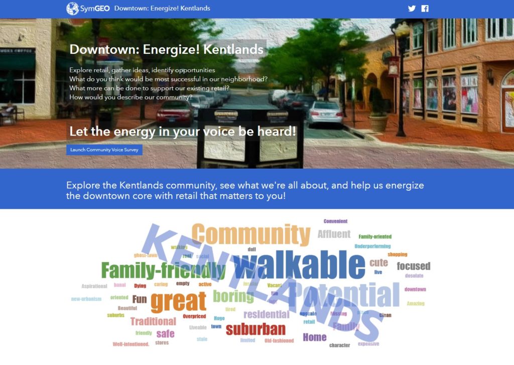
Our second listing is a partner solution focused on an ArcGIS Hub configuration called Downtown: Energize!. This solution is configurable for cities or communities looking to energize their downtown core with retail that fits the needs of the local population. This solution empowers the local community to explore retail in their area and to voice their opinions on what types of new commercial development they feel would do well.

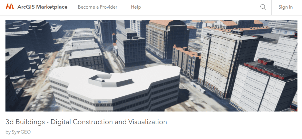
Our third listing provides information about our 3d building modeling capabilities. This solution leverages ArcGIS Pro for 3d model production, ArcGIS CityEngine for model texturing, analysis, and landscape refinement, and Unreal Engine by Epic Games for rendering and visualizations. Whether the goal is a digital twin or proposed development scenarios, the end result is a virtual environment that can’t wait to be explored!

To learn more about our marketplace listings or any of our services, contact us to set up a time to talk – SymGEO is a certified Esri specialist and is here to help!