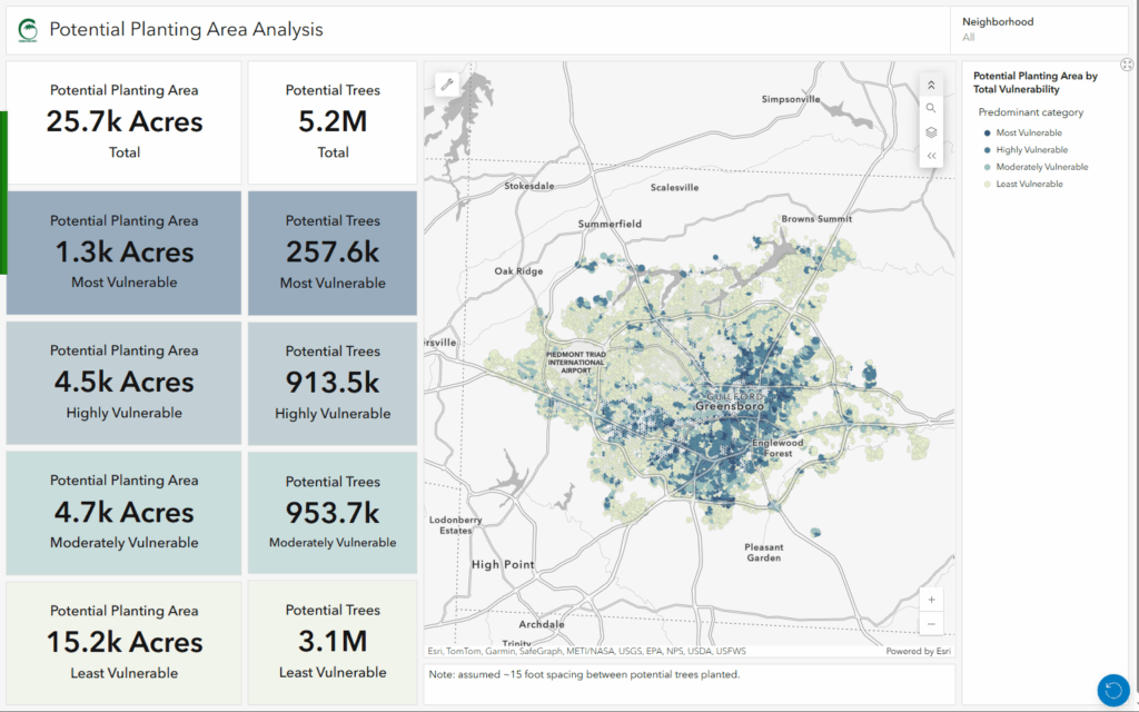
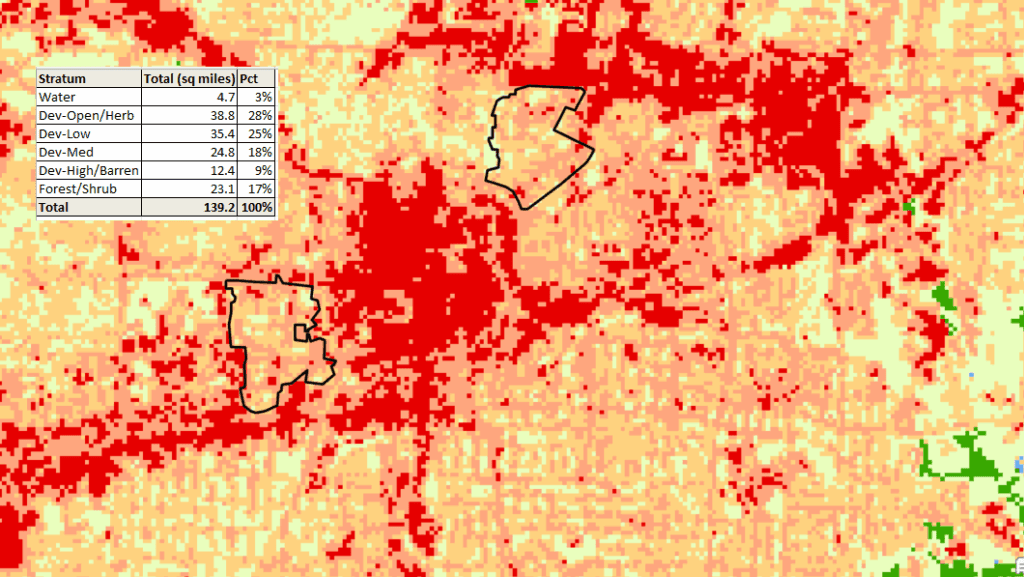
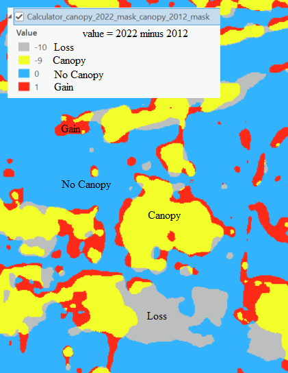
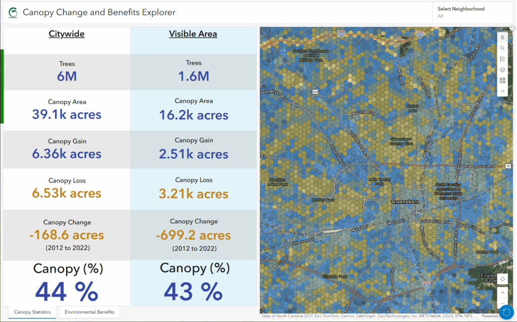
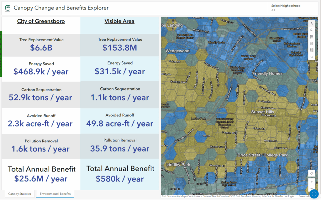
Urban trees in the city are critical to our well-being. Among many other benefits, trees improve our air and water quality, cool our neighborhoods, and provide nurturing habitats for birds, bees, and numerous wildlife. Large trees provide greater environmental benefits than smaller trees and are protected from unnecessary damage or removal by the Urban Forest Preservation Act and the Tree Canopy Protection Act in the District of Columbia.
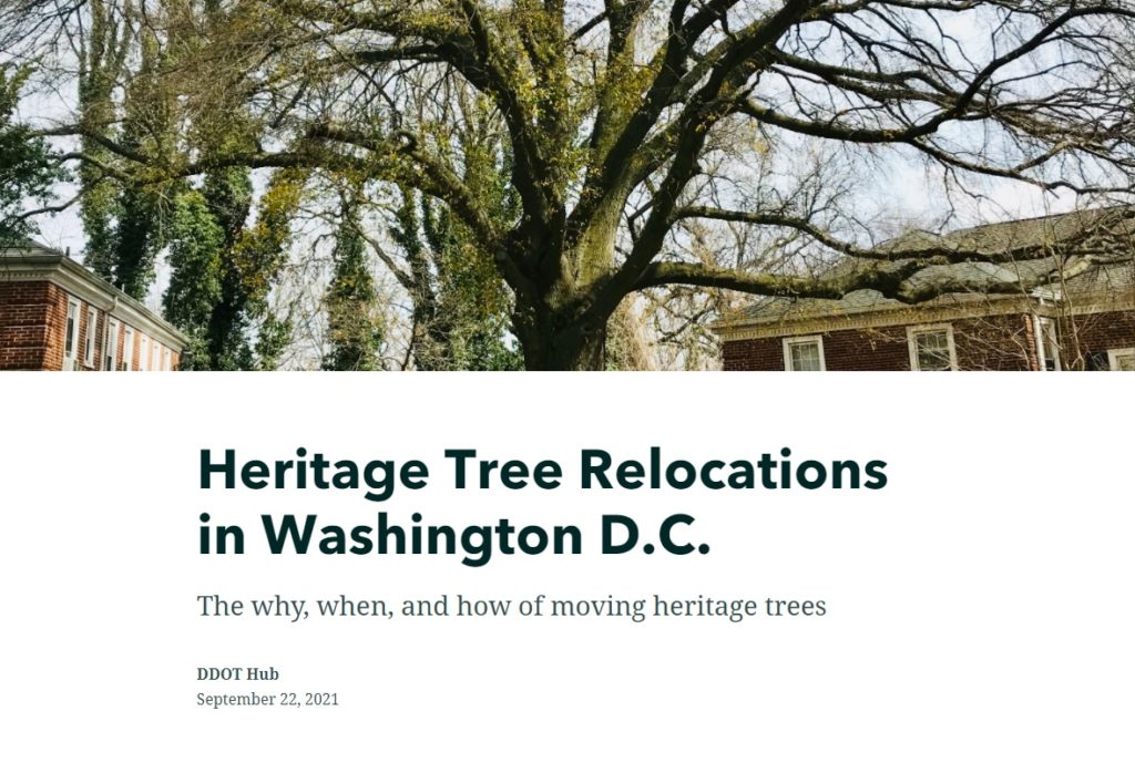
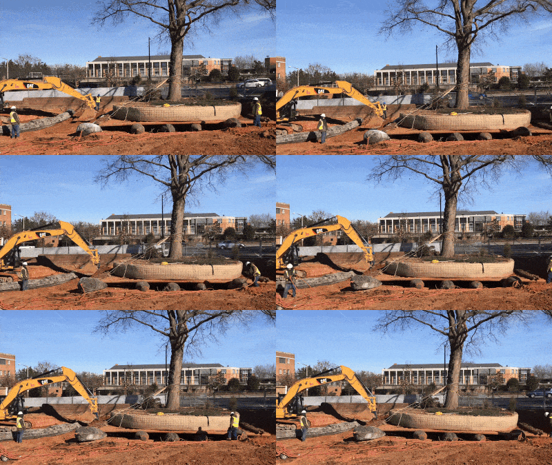
Learn all about the how, why, and when large “heritage” trees in D.C. have to be moved out of harm’s way during construction projects in a new StoryMap developed in collaboration with the Urban Forestry Division of the District Department of Transportation (DDOT).
Talk to our industry experts today if your agency or organization is interested in community engagement with the power of Esri’s StoryMap technology – SymGEO is a certified Esri business partner and is here to help.
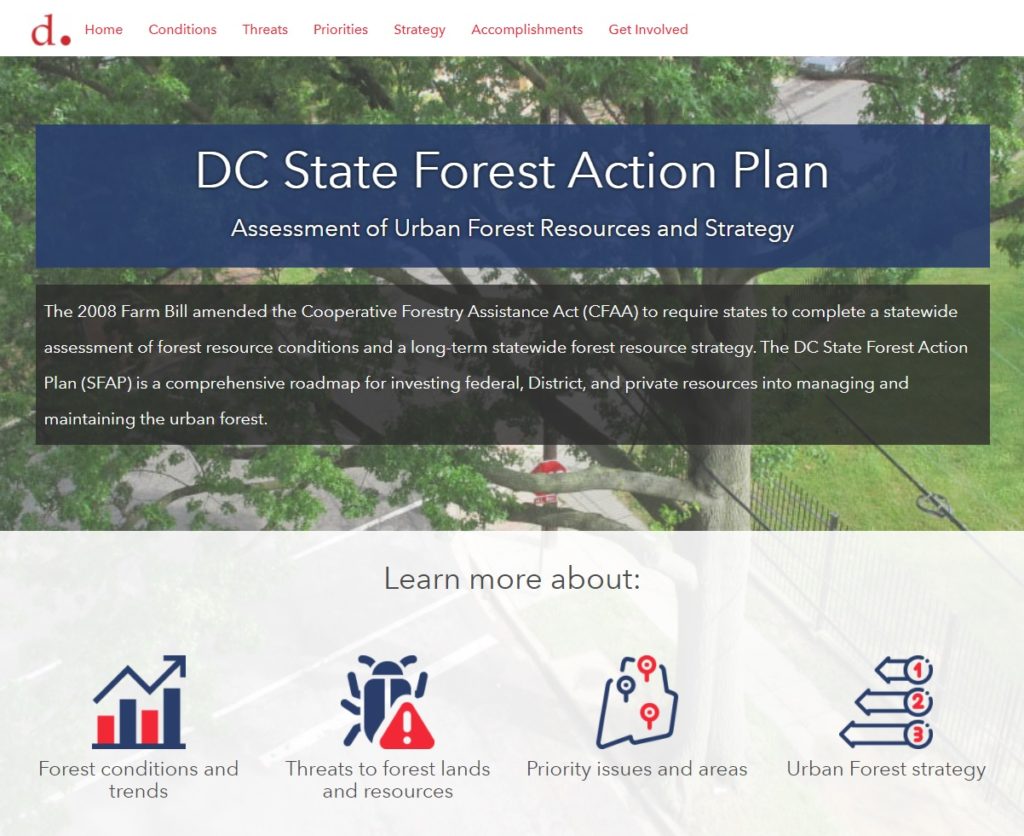
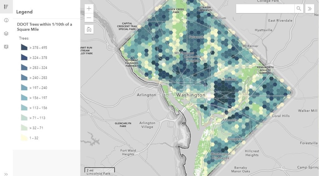
The District Department of Transportation (DDOT)’s Urban Forestry Division (UFD) is the primary steward of Washington DC’s 170,000+ public trees and has a mission of keeping this resource healthy, safe, and growing. Among many other benefits, urban trees improve the air and water quality, cool the neighborhoods, and provide critical habitat for birds, bees, and urban wildlife. As part of their long-term statewide forest resource strategy, the UFD has created the DC State Forest Action Plan (SFAP). This plan is a comprehensive roadmap for investing federal, District, and private resources into managing and maintaining the urban forest.
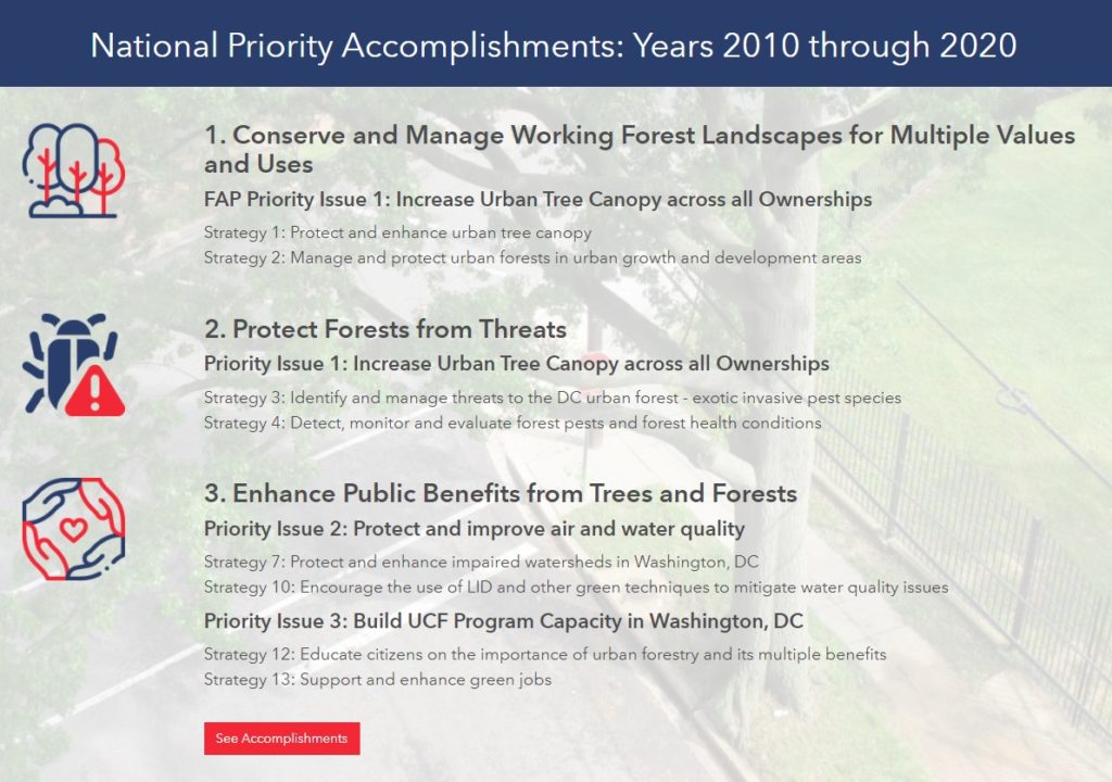
To help highlight the achievements and findings of the plan, SymGEO created the DC SFAP Hub site, full of condensed information from the full report.
The DC SFAP Hub site integrates numerous data sets, Dashboards, StoryMaps, and other helpful visualizations to support the findings of the report and long-term strategy.
Key accomplishments from the last ten years are presented with links to further information and full documentation.
Explore the DC SFAP Hub site to learn more about D.C.’s forest conditions and trends, threats to forest lands and resources, priority issues and areas, and the long-term urban forest strategy.
Talk to SymGEO industry experts today if your agency or organization is interested in community engagement with the power of Esri’s ArcGIS Hub, Dashboards, or ArcGIS StoryMaps – we are here to help!
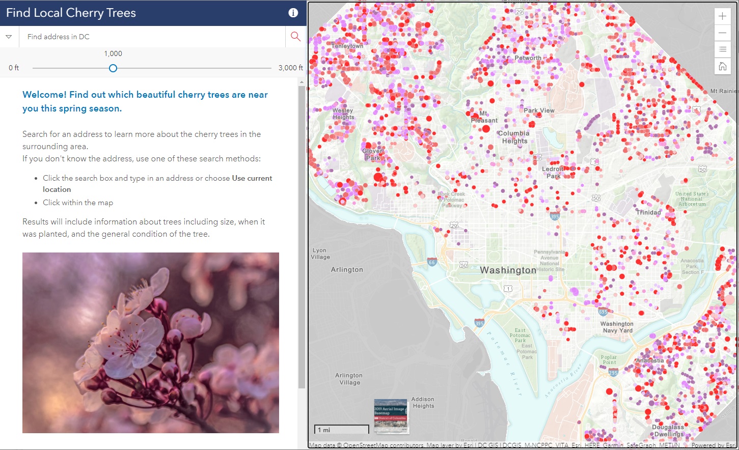
Did you know that there are almost 10,000 cherry trees outside of the tidal basin to see throughout D.C.? SymGEO was honored to help DDOT build the DC Local Cherry Tree Finder leveraging the Urban Forestry Division‘s tree inventory and ArcGIS Online‘s configurable applications to quickly assemble and launch in time for peak blooming.
If you missed it this year, don’t worry, there’s always next spring season!
Talk to our industry experts today if your agency or organization is interested in community engagement with the power of Esri’s ArcGIS mapping solutions – SymGEO is here to help!
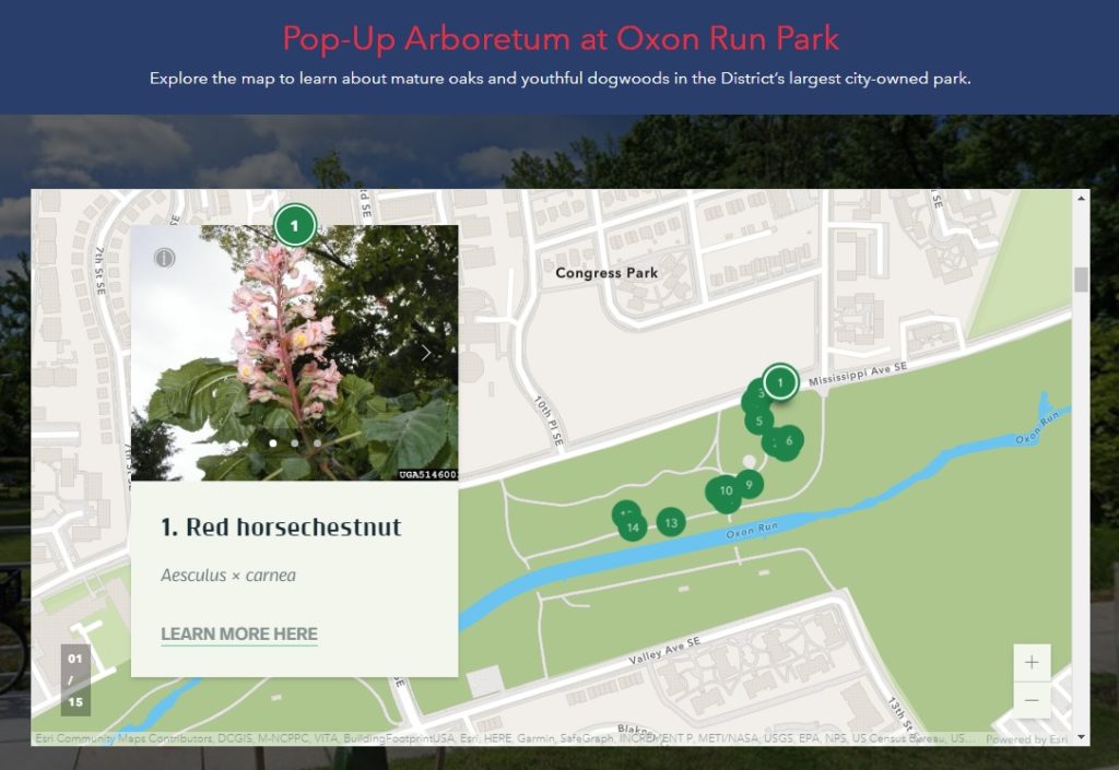
An arboretum is a place where trees, shrubs, and other plants are grown for scientific and educational purposes. A park typically has trees, shrubs, and other plants for the enjoyment of families and friends. Why not have an arboretum in a park? Genius! Check out the first “pop-up arboretum” at Oxon Run Park in Ward 8 by the District Department of Transportation’s (DDOT) Urban Forestry Division. SymGEO is pleased to help launch the Pop-Up Arboretum website with all the specifics of what amazing things can be found at this natural outdoor exhibit.
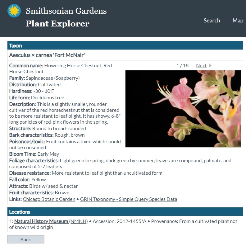
The site is built using ArcGIS Hub technology and features an ArcGIS StoryMap designed to help guide people on their outdoor educational adventure. The site also links to scientific information about each tree species provided by the Smithsonian Institute’s Plant Explorer.
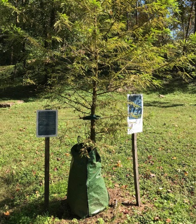
Signs are posted on or near the trees in English and Spanish with QR Codes that link back to the Pop-Up Arboretum website for further information. Be sure to enjoy our natural environment while learning all about the trees at Oxon Run Park!
Talk to our industry experts today if your agency or organization is interested in community engagement with the power of Esri’s ArcGIS Hub or ArcGIS StoryMaps – SymGEO is here to help!
Did you know that any Washington DC resident or contractor who wishes to plant, prune, or remove a tree within the public right of way must first obtain permission from the District Department of Transportation (DDOT) and the Urban Forestry Division? However, knowing when, where, and how to get the right permit for tree work in DC can be a complicated process. Fortunately, DDOT has a new resource available to make it easy! Check out the Tree Permitting Hub site to answer all tree permitting questions.
SymGEO built the Tree Permitting site using ArcGIS Hub technology, which leverages ArcGIS Online mapping and graphic examples to help explain what type of permit is needed based on tree location, property boundaries, and tree size. The site also explains the benefits of the Income Contingent Hazardous Tree Mitigation Program that provides assistance with the removal of a hazardous tree on an owner’s private property.
As an example of “good to know” information, Washington D.C. is unique in that it has dedicated park space along most streets. This “parking” area is generally used for landscaping, retaining walls, trees, and other greenery. Just like on private land, all landscape elements (including trees) in this parking area are the responsibility of the homeowner to maintain. On the other hand, all trees located in the public “sidewalk” area are the responsibility of the city to maintain. However, these trees may be negatively impacted by development or construction projects and need to be considered before projects begin.
Talk to our industry experts today if your agency or organization is interested in community engagement with the power of Esri’s ArcGIS Hub or mapping with ArcGIS Online – SymGEO is here to help!
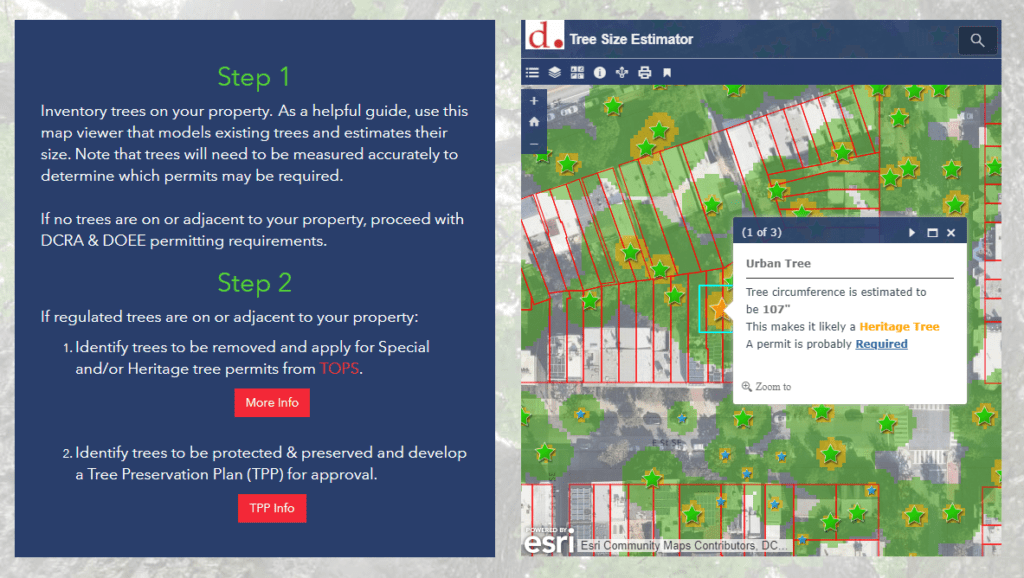
Did you know that trees are so important to Washington DC that they are protected by the Urban Forest Preservation Act and the Tree Canopy Protection Act? This means that before performing any excavation or construction activity on private property, it is important to consider any potential impacts to the trees on site. To facilitate this process, SymGEO is proud to help DDOT launch a new resource, the Tree Preservation Hub site, for property owners and construction companies to identify which trees need to be protected and how to best take care of them during home renovations or new construction projects.
Built using ArcGIS Hub technology, this site leverages ArcGIS Online mapping and graphic examples to help explain what type of permit or protection plan is needed based on estimated tree size. Tree sizes were estimated using LiDAR processing, which in turn is used to estimate the critical root zone and structural root zones that need to be protected during construction. Modeling several hundred thousand trees at the same time has its challenges; however, ArcGIS Pro, ArcGIS Enterprise, Arcade expressions, and hosted image services were used to efficiently capture and share the modeling results.
Talk to our industry experts today if your agency or organization is interested in community engagement with the power of Esri’s ArcGIS Hub or data processing with ArcGIS Pro – SymGEO is here to help!
“Every day is Arbor Day in the City of Trees!” – these wise words from Dr. Kasey Yturralde, the Forest Health and Community Outreach Specialist at DDOT’s Urban Forest Division (UFD), are a great indicator of the passion and excitement possessed by the entire UFD team keeping our city green and beautiful.
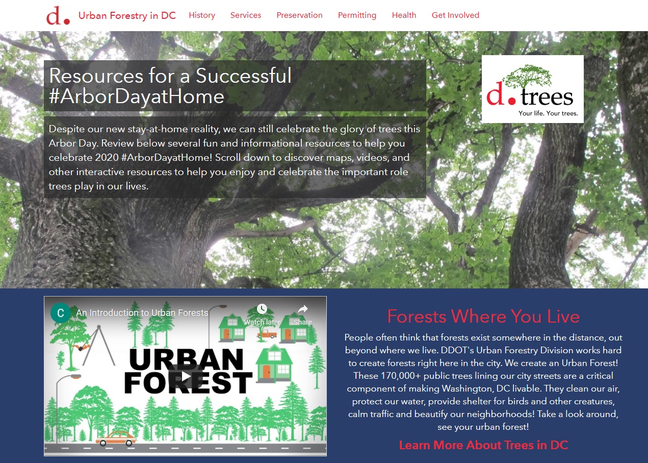
With that in mind, SymGEO is pleased to announce a brand new interactive Arbor Day at Home resource for communities and individuals who share the same passion for our neighborhood trees. This dynamic website, built with ArcGIS Hub technology, showcases a number of best-practices when planting or caring for trees, as well as fun activities for the whole family in identifying local tree varieties.
Talk to our industry experts today if your agency or organization is interested in community engagement with the power of Esri’s ArcGIS Hub – SymGEO is here to help!
SymGEO is pleased to announce the development of two new D.C. forest structure datasets created in partnership with DDOT Urban Forest Division, using LiDAR data managed by OCTO and the DC GIS program. The final version of this dataset will help Urban Foresters manage the canopy by providing important attributes including tree height, canopy width, and forest structure information.
A little background: LiDAR data is a digital cloud of millions of elevation points typically gathered by a low-flying airplane or ground-level vehicle. The elevation is recorded at every surface the measuring laser beams hit, so in the case of a forest, it will capture the top of the trees, some branches, as well as under-story vegetation and ground elevation. The LiDAR used for this project was also classified by the provider into a number of useful categories, including buildings, ground, and high / medium / low vegetation.
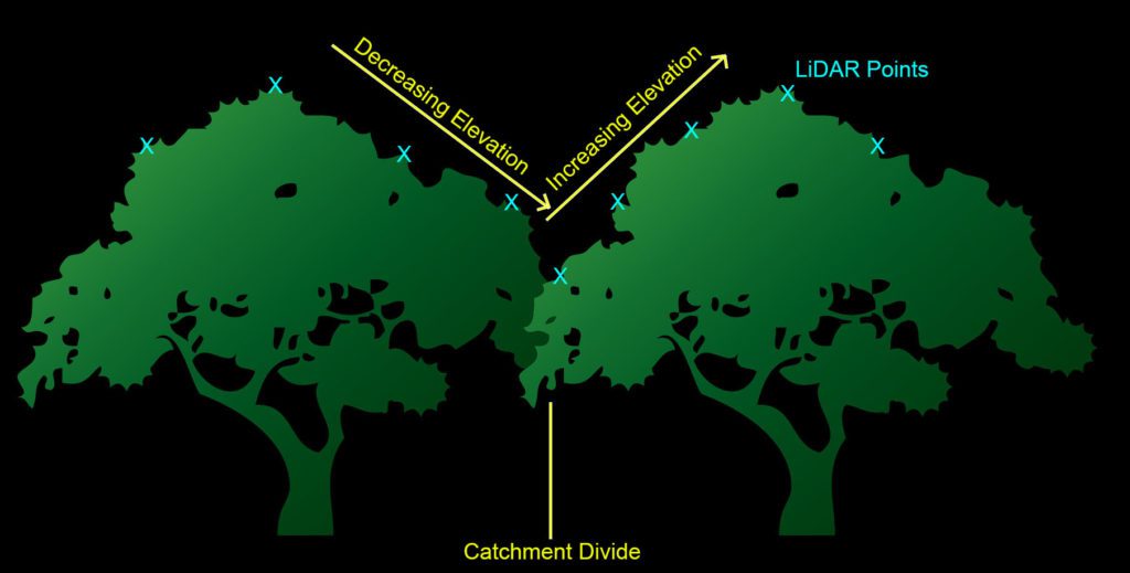
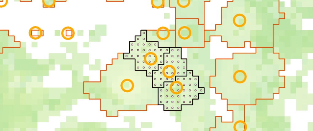
Using an innovative method, SymGEO used the ArcHydro toolset to create “catchment” areas for each tree, with tree locations being determined by the UFA Street Trees dataset. Each tree point was given an artificially high elevation value, and then all surrounding vegetation points around the tree point were examined. If the model determined that the vegetation points were connected to the tree, then it was included in the catchment. If an adjacent tree was found (indicated by adjacent vegetation elevation points increasing in height), then the catchment was divided into the two tree areas. Kind of technical, but maybe the graphic below will help 🙂
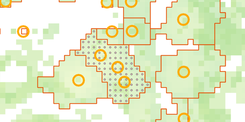
This catchment method worked quite well; however, it did suffer from capturing multiple trees in the same catchment. Fortunately, these cases were isolated quite easily be doing a spatial join between the catchment areas and street tree points, and identifying many-to-one joins.
For these cases, the catchment areas were converted into a grid of points, and the points were joined to the nearest tree. They were then back into areas (with the new tree ID as an attribute), effectively splitting up the area into smaller areas that had a one-to-one join with the tree points.
Once the tree area was established and cleaned up through manual inspection of outliers, attributes including tree height and average canopy width are assigned to each tree. These attributes will help the Urban Forestry Division manage the tree canopy even more effectively.
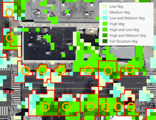
A secondary dataset was also produced using the LiDAR data that categorized areas into high, medium, or low vegetation, so some combination thereof. This helps the Urban Forestry Division prioritize areas for under-story plantings or the establishment of new urban canopies. This data set suffered a little from miscategorized LiDAR points, but it is a good starting point for an urban canopy structure dataset.
If you have access to a LiDAR dataset, and are interested in learning more about derivative products, contact us today – SymGEO is here to help!
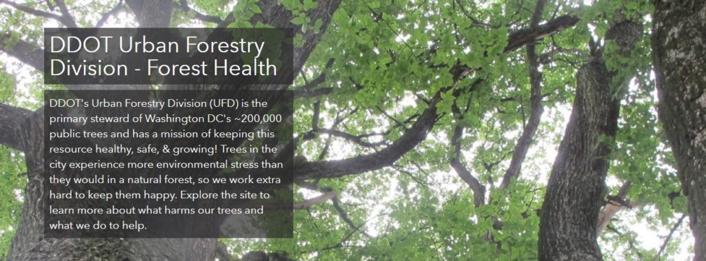
SymGEO is pleased to announce the launch of a Forest Health website for DDOT’s Urban Forest Division (UFD), designed to educate the community on how DDOT (and DC residents!) help keep the urban canopy vibrant, healthy, and productive. In a natural ecosystem, there are many checks and balances to keep a forest healthy. Urban environments present many challenges to trees, which include the urban heat island effect, degraded soil, limited growing space, and the introduction of exotic pests. This can lead to pest infestations and canopy damage if not caught quickly and mitigated efficiently. Fortunately, at the DDOT Urban Forestry Division, dedicated specialists prevent and respond to urban forest health issues on a daily basis.
“We are excited to share our forest health programs with the public in this new format. The new forest health website is dynamic and easy to use, it allows users to learn about pests and pathogens to look out for, while also giving them the opportunity to report their observations.”
– DDOT Urban Forestry Division
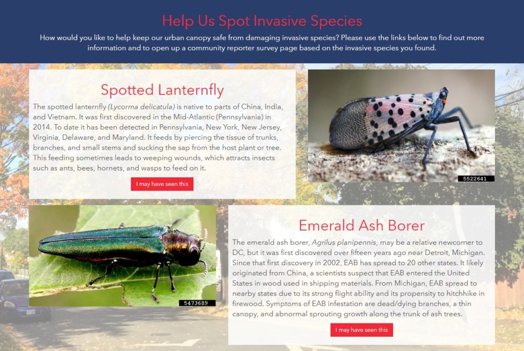
The new Forest Health site discusses a range of preventative measures the UFD takes against pests, including the Early Detection Rapid Response (EDRR) and the Cryptic Wood-Borer Insect (CWBI) programs, as well as how DC residents can identify and report invasive species.
The site leverages Esri’s ArcGIS Hub framework for design and mobile responsiveness and Esri’s Survey123 for ArcGIS for pest reporting. Information is gathered through the website, including pest species, life stage, or signs/symptoms, and is passed to the survey to help the reporting process along.
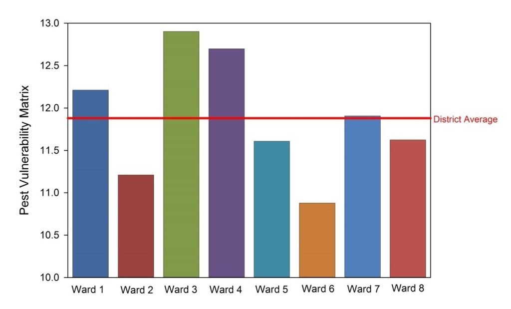
A Pest Vulnerability Matrix (PVM) is also presented which enables urban foresters to evaluate the overall vulnerability of the urban forest and evaluate the potential impacts of emerging pests and diseases.
Talk to our industry experts today if your agency or organization is interested in community engagement with the power of Esri’s ArcGIS Hub – SymGEO is here to help!
Teaching kids the importance of nature, recycling, history, and culture is a lofty goal. Perhaps it’s a lesson that could be taught from the comfort of a bench constructed from recycled urban wood sourced from a local DC neighborhood rich in cultural history? This is now possible thanks to the District Department of Transportation (DDOT) Urban Forestry Division (UFD)’s new initiative called “Urban Wood Reuse: for Schools“. This partnership with the Office of the State Superintendent of Education (OSSE) will provide DC Public Schools and public charter schools with wood products to improve school grounds at no cost.
SymGEO was excited to help the Urban Forestry Division (UFD) develop this initiative by using Esri’s ArcGIS Hub technology to establish two-way communication between the UFD and DC schools interested in “sitting on a piece of DC History”. The site shares knowledge and products from the UFD while gathering the school’s product ideas and requirements.
The site discusses the benefits of wood reuse, where the wood comes from, and the variety of products available including benches, stumps, or woodchips. It also provides a link to an order form as a convenient and easy way to request wood products.
The order form itself is powered by Esri’s Survey 123 for ArcGIS technology and is designed with step-logic where pertinent questions appear based on previous answers.
One of the exciting new aspects of an initiative is the ability for an audience member to sign into a community account and “follow” the initiative. This will grant them access to broadcasts about new events, updates, new product launches, and other useful information. Now, being able to show which schools are as excited as we are about this new initiative has never been easier!
Talk to our digital platform experts today if your agency or organization is interested in community engagement with the power of Esri ArcGIS Hub Initiatives – SymGEO is here to help!