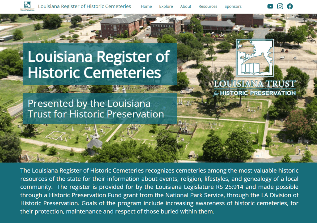
Louisiana Register of Historic Cemeteries

The Louisiana Register of Historic Cemeteries recognizes cemeteries among the most valuable historic resources of Louisiana for their information about events, religion, lifestyles, and genealogy of a local community. Recently brought to life by a Historic Preservation Fund grant awarded to the Louisiana Trust for Historic Preservation (LTHP) from the National Park Service, the goals of the program include increasing awareness of historic cemeteries, for their protection, maintenance and respect of those buried within them. As part of this important effort, SymGEO was honored to partner with LTHP to build the web infrastructure to house the historic cemetery data and enable stakeholders to contribute to this growing, interactive library.

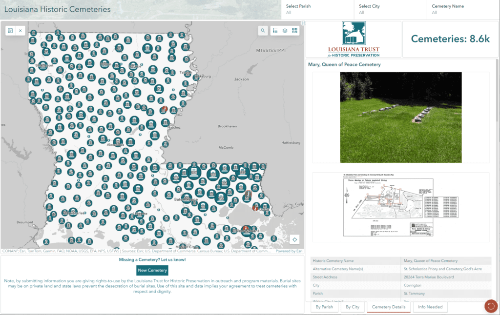
Built using ArcGIS Hub technology, the site features an interactive Historic Cemetery Dashboard that tracks all known historic cemeteries in Louisiana. Clicking on a cemetery icon will give basic information about the site, while cemeteries with detailed information and site pictures are differentiated by symbology.

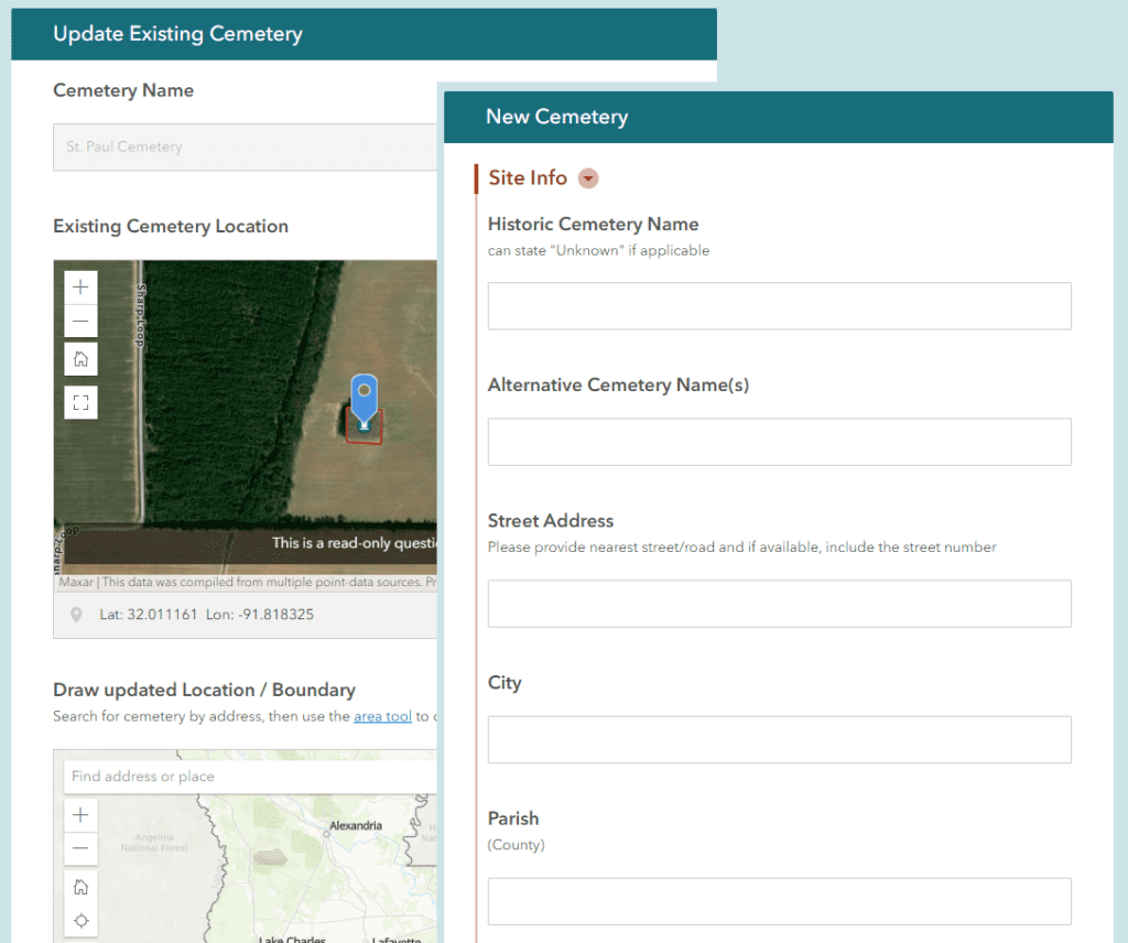
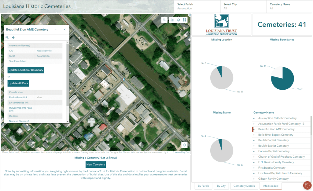
An innovative twist in the Dashboard is presented by the “Info Needed” tab, where users can see which cemeteries are missing names, locations, or boundaries. If they are familiar with a cemetery on the list (filtered by parish or city), they are presented with the option of updating either the basic geographic cemetery information, or completing a more detailed information form, including picture upload options.

Built using ArcGIS Survey123, the forms include step logic to allow data updates or new cemetery information to be easily added to the growing collection of historic knowledge.

“The first step in protecting and respecting historic burials is to be aware of their location. By crowdsourcing this data beyond our initial research, we are able to learn about historic cemeteries in remote locations which may not appear on topographic maps or have even been used in over a century. The program will benefit descendants; industries such as tourism, real estate and construction; and should foster increased protection and maintenance at cemeteries.”

– Executive Director, Louisiana Trust for Historic Preservation

Talk to SymGEO today if your organization would like to feature projects or sites using the power of Esri’s ArcGIS Online platform – we are certified experts and here to help.
Preservation Society of Charleston Site Dashboards

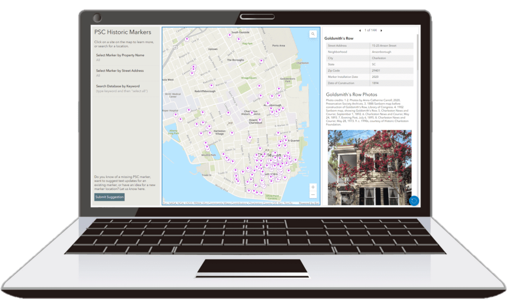
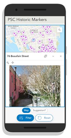
The Preservation Society of Charleston (PSC) is a nonprofit organization established in 1920, dedicated to the preservation and enjoyment of the distinct character, quality of life, and diverse neighborhoods in Charleston, South Carolina. To assist in these efforts, SymGEO partnered with PSC to build a pair of project dashboards to feature their Charleston Justice Journey (CJJ) and Historic Marker program sites. The dashboards were built using ArcGIS Dashboards technology and designed to be mobile responsive for information on the go.

The Charleston Justice Journey (CJJ) project was launched in 2019 to recognize sites significant to African American history and the ongoing journey toward racial equality in Charleston and the Lowcountry. This online research and mapping initiative is a growing resource for deepening our collective understanding of people, institutions, movements, and events that shaped the course of the region’s civil rights history. Through this project, PSC is partnering with the community to elevate the full narrative of Charleston’s history.

The Historic Marker program was established in 1959, with well over one hundred markers placed around the city so far. The PSC sought to create a digital database of markers, that would be a resource for Charlestonians and visitors alike, with baseline stats and photographs of the markers, properties, historical photographs, drawings, and other information related to associated historical figures and events. Using the PSC Historic Marker Database, members of the public can create their own walking tour, research from afar, and learn more about the city’s vibrant cultural and architectural history.

“SymGEO played a key role in helping us build both of these important digital platforms. After listening carefully to our goals and answering every one of our questions, they helped us create two distinct interactive platforms that are user-friendly, informative, and advance our mission to protect and make Charleston’s cultural and architectural fabric more accessible to all.”

– Preservation Coordinator, Preservation Society of Charleston

Talk to SymGEO today if your organization would like to feature projects or sites using the power of Esri’s ArcGIS Online platform – we are certified experts and here to help.
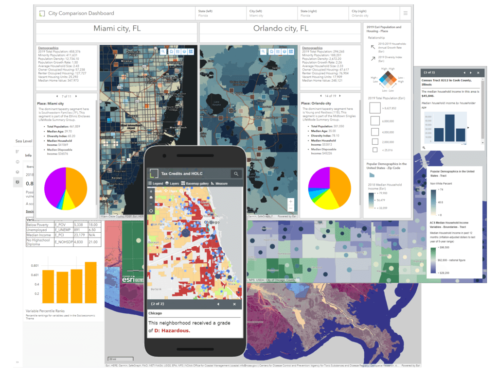
Lincoln Institute of Land Policy Hubsite

The Lincoln Institute of Land Policy seeks to improve quality of life through the effective use, taxation, and stewardship of land. As a nonprofit private operating foundation whose origins date to 1946, the Lincoln Institute researches and recommends creative approaches to land as a solution to economic, social, and environmental challenges. Through education, training, publications, and events, they integrate theory and practice to inform public policy decisions worldwide.

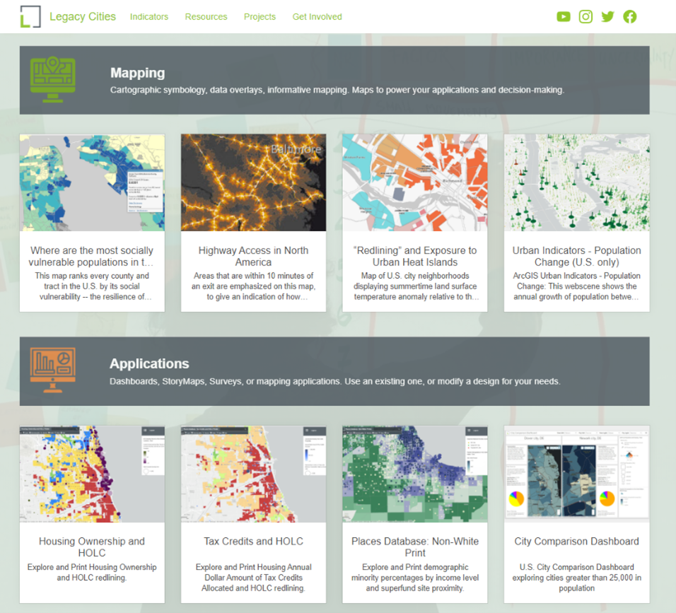
SymGEO partnered with the Lincoln Institute to build an internal, central ArcGIS Hub platform and support five of their Centers and Initiatives. This involved curating and displaying authoritative data layers detailing resource equity, population demographics, historic redlining information, land zoning information, and historic city spending and revenue information among others.

Configurable applications, including ArcGIS Dashboards and web applications, were built to facilitate the exploration of data and visualization of analytical results.


“SymGEO has the unique ability to distill content into compelling visual geospatial products and narratives that tell a story and help track impacts. They are very proactive, responsive, great communicators, and can spin up apps quickly as proof of concepts that help with design decision-making. It has been a great experience working with them collaboratively, and I highly recommend SymGEO as a geospatial solution expert.”

– Director, Partnerships and Strategy, Lincoln Institute of Land Policy

Talk to SymGEO today if your organization would like to build a central spatial data hub framework using the power of Esri’s ArcGIS Online platform – we are certified experts and here to help.