Graduated, Certified, and Ready to Partner

SymGEO is pleased to announce that we have graduated the Esri Startup Program a year and a half early and have joined the Esri Partner Network as a Silver Tier partner. This elevated partnership status is a direct result of our focus to integrate best-in-class ArcGIS technology into our products and our determination to benefit our clients with a long-term Esri partnership.

“The Esri Partner Network is a rich ecosystem of organizations that work together to amplify The Science of Where. Partners deliver solutions, content, and services using the Esri Geospatial Cloud. Alliances are industry leaders aligned with Esri’s high level goals, joining forces to advance shared initiatives.”

– Esri

We have also been included in the Esri ArcGIS Online Specialty program in recognition of our proven set of value-added services and solutions that help users implement and optimize ArcGIS Online within their organizations.

Finally (for now!), SymGEO is honored to be part of the Esri ArcGIS for Local Government Specialty program. This designation is for promoting and implementing ArcGIS apps, maps and solutions for local government.
“As a proud Esri business partner, we are so grateful for all the support, encouragement, and technical resources that Esri has generously shared with SymGEO. We have benefited tremendously from Esri’s business guidance, shared best practices, and professional friendship!” 

–  Kevin McMaster, Principal, SymGEO

Talk to our industry experts today to hear more about our innovative, cost-effective, mapping solutions that leverage Esri technology – SymGEO is here to help!
Local Government Solution: Citizen Problem Reporter

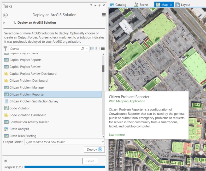
How great would it be to have a solution already developed for you and only some configuration is needed to roll it out? Today we look at the “Citizen Problem Reporter” solution developed by Esri to address a reoccurring need in local government.

Every local government has access to real-time, mobile sensors that travel throughout their jurisdiction on a daily basis. You guessed it, their citizens are their sensors! People notice issues left, right, and center. When armed with the right tools, people can be the eyes and ears of the community, giving near-instant notification of any concerns. These may range from dangers such as downed power-lines, or trash that wasn’t collected, or graffiti, or… the list goes on!

To help get the solution jump-started, Esri has developed a set of data and applications that fit together into a government’s ArcGIS online account.

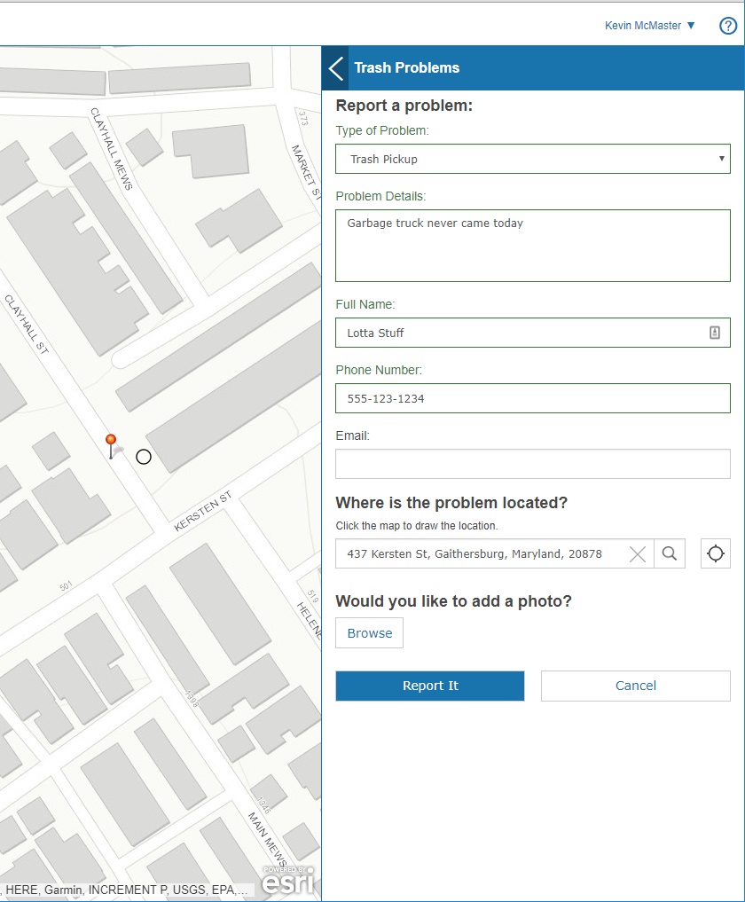
The solution includes an application that a citizen uses to report a problem through a fully mobile-responsive web interface. Great for easy access on the go!

citizen reporter application

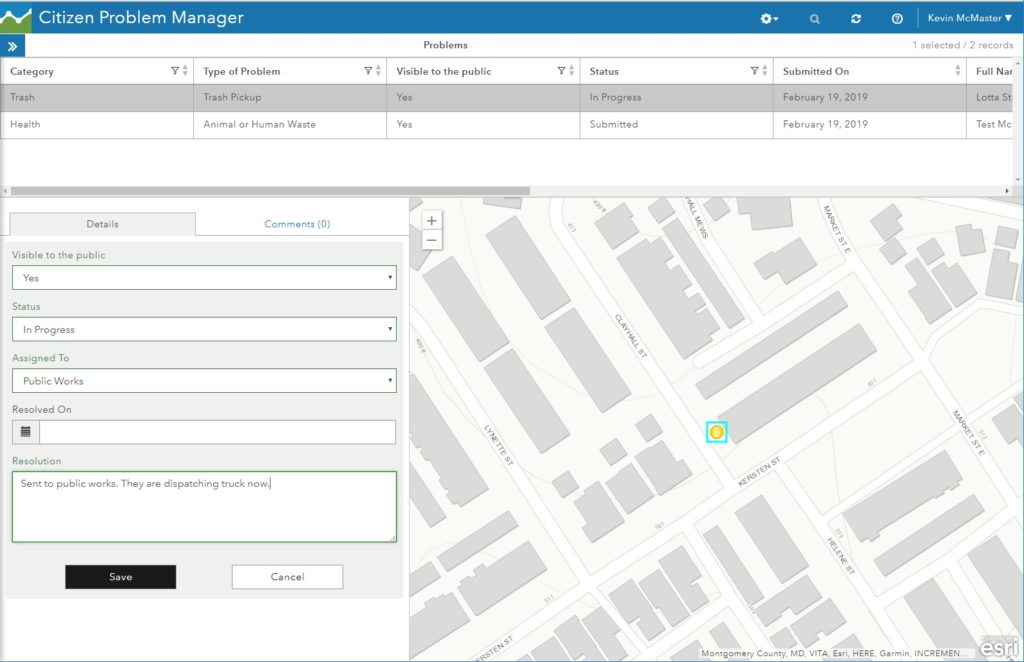
Once reported, the citizen problem manager sees all the issues using a separate application. They will route the issue to the appropriate department, add notes, and update the resolution status.

citizen problem manager

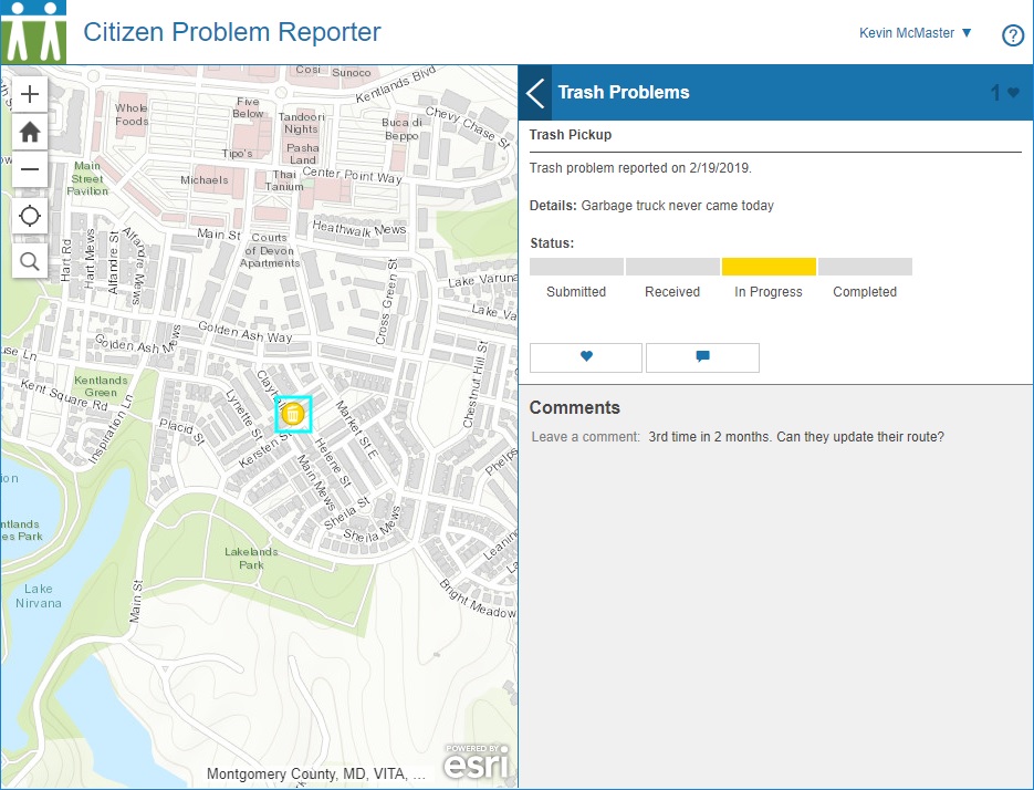
Citizens see the status of all issues through their application and know that they are being addressed. People can add notes, “up-vote” an issue, and make it into a social media platform if desired.

citizen problem reporter social

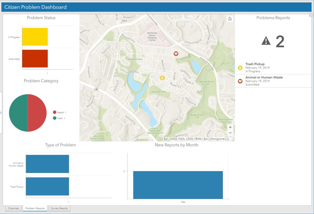
On the manager side, a dashboard keeps track of all issues that have been recently submitted. This helps to spot trends and identify departments that may need extra resources to address the needs.

issue dashboard

A statistical component of the dashboard keeps track of the requests over time and displays the status of all requests.

issue dashboard status

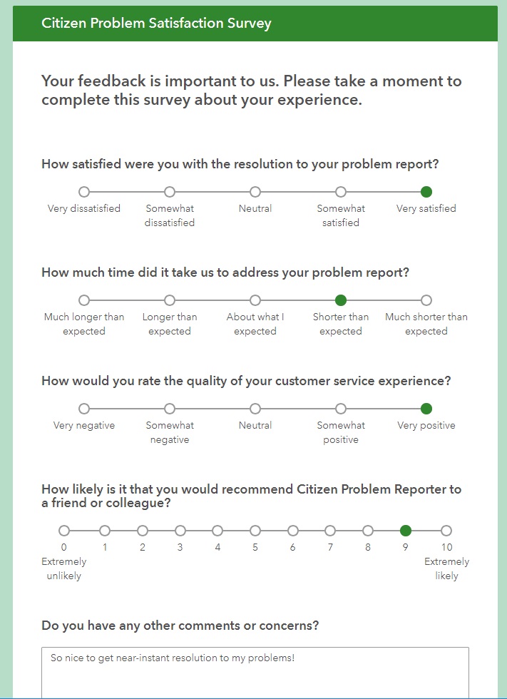
Optionally, a survey can be sent to the citizen who reported the issue to help close the loop and keep them engaged with the process.

reporter survey

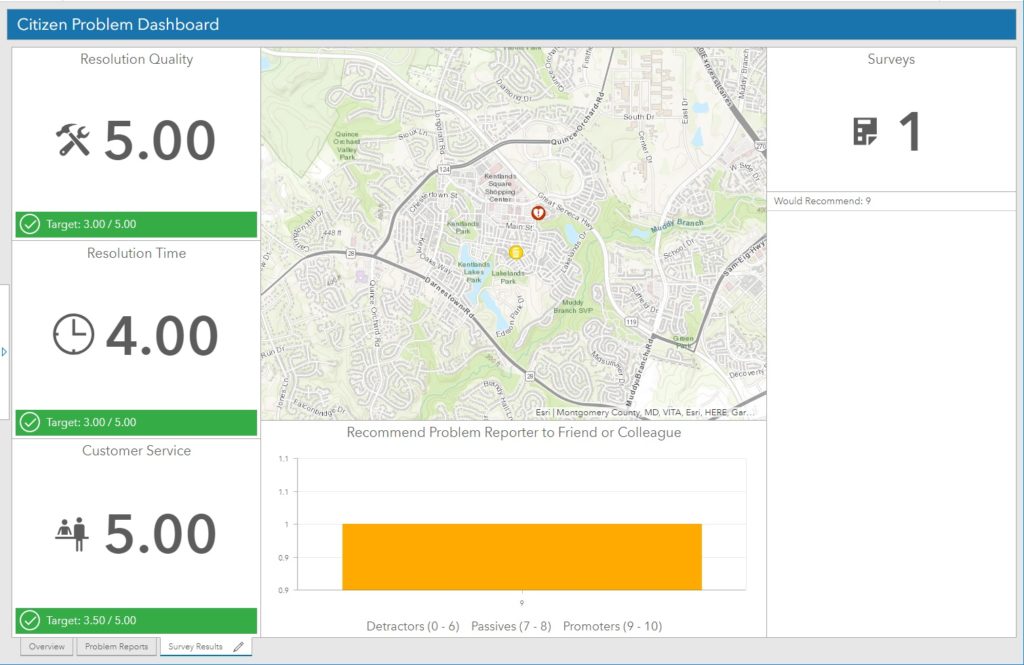
Finally, the manager dashboard also keeps track of survey responses. This is helpful to view perceived responsiveness of the department and show where improvement may be needed.

reporter survey dashboard

This local government solution is just one of many that have been pre-assembled and tested by Esri professional staff.

If you’d like help deploying this or other Esri Local Government Solutions, let SymGEO know, as we’re here to help!