The National Forest Foundation (NFF) was chartered by Congress and created with a simple mission: bring people together to restore and enhance our National Forests and Grasslands. Part of this nonprofit mission includes planning for wildfires and mitigating their impact by understanding fire behavior across a landscape. SymGEO was honored to partner with the NFF to explore wildfire modeling approaches and analytical results by combining GIS data processing with the Interagency Fuel Treatment Decision Support System (IFTDSS). The results of this project will help inform internal planning efforts and future studies.
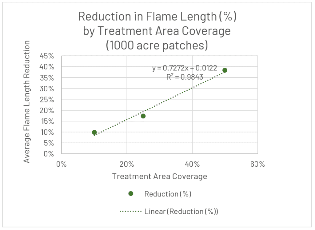
The project area was located in Flathead National Forest, Montana, and was approximately 250,000 acres in size. Extensive modeling was performed using IFTDSS to determine how effective different landscape treatments were at varying treatment patch area sizes and total coverage amounts. Conceptually, treating fewer large patches would be more effective than treating a greater number of small patches distributed across the landscape (based on wildfire behavior). However, determining the level of effectiveness required landscape modeling and statistical analysis. Similarly, other relationships were explored, such as what is the relationship between the total treatment area and treatment effectiveness? Does a 10% coverage result in a 10% decrease in modeled wildfire results? What happens at 50% coverage? Only one way to find out!
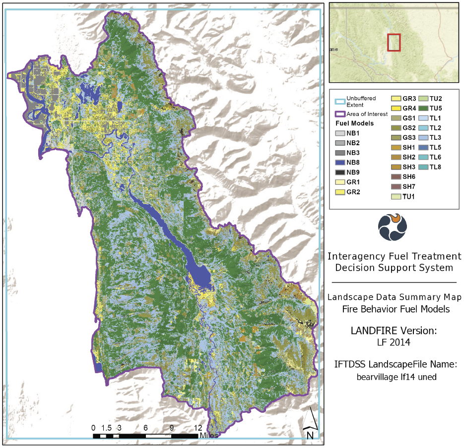
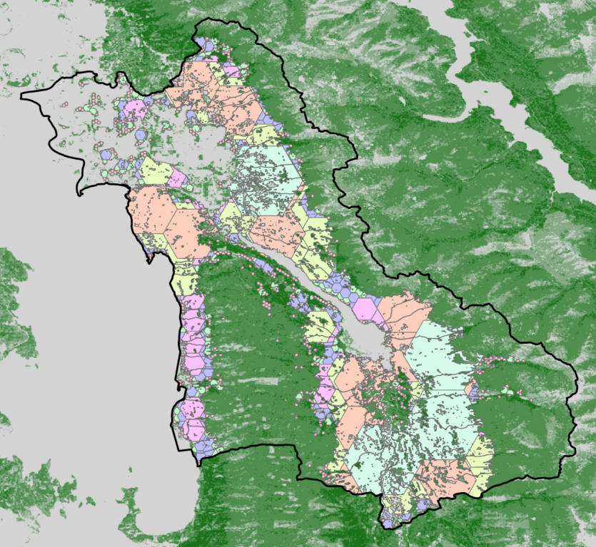
GIS processing using ArcGIS Pro was used to screen out areas that couldn’t be treated based on slope, canopy cover, distance to streams, fire return interval, and several other factors. Tessellated grids were then developed at scales ranging from 100-acre patches up to 5,000-acre patches and fit into the treatable areas.
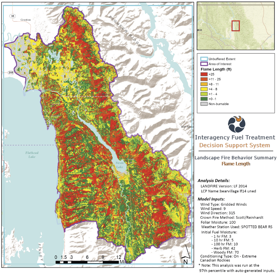
Average flame length was measured for untreated base conditions and then used to measure the effectiveness of treatment options.
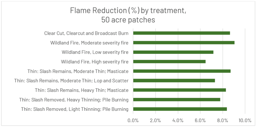
Initial results indicate that measurable differences were observed across treatment types, treatment patch sizes, and treatment total coverage areas.
“SymGEO provided expert guidance around the analytical approach to explore fire resiliency GIS modeling. The IFTDSS modeling they provided was appreciated along with the framework to help the National Forest Foundation continue this important endeavor. They are excellent to work with and highly engaged in the process.“
– GIS Program Developer, National Forest Foundation
Talk to SymGEO today if your organization wants to explore data modeling processes and analytical results using ArcGIS Pro together – we are certified experts and here to help.
