Arborist Workload Optimization

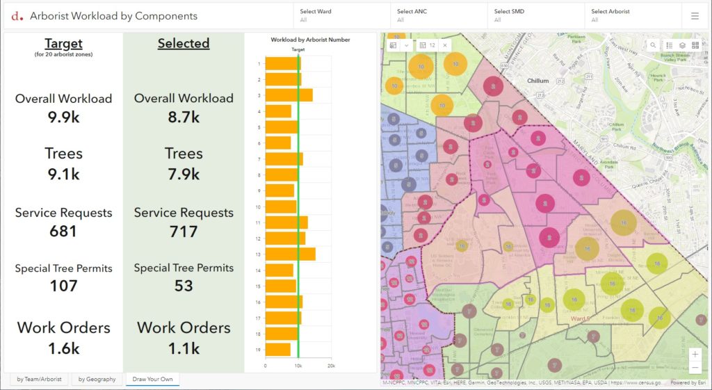
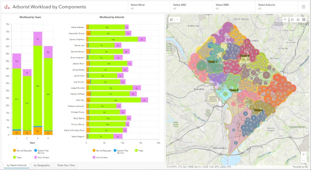
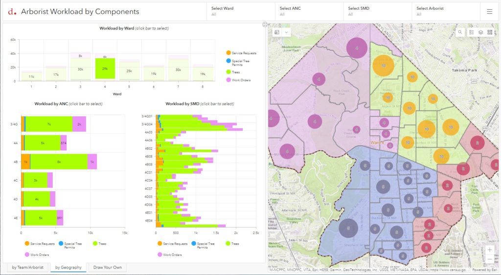
DDOT’s Urban Forestry Division (UFD) is the primary steward of Washington, D.C.’s ~175,000 public trees and has a mission of keeping this resource healthy, safe, and growing. At the front lines of this work is a team of almost twenty Urban Foresters who have district boundaries within which they provide tree services, inspections, special tree permit processing, and work order generation for tree planting, pruning, and removals as well as other daily responsibilities. As the tree canopy composition and jurisdictional boundaries change over time, workload optimization between arborists is key to keeping the process flowing smoothly. To help provide visibility into current workloads and explore proposed re-districting options, SymGEO worked with DDOT to build an Arborist Workload Dashboard using ArcGIS Dashboards technology.

The dashboard leverages Arcade expressions to aggregate workload components by arborist teams and proposed arborist boundaries, as well as display the proportional work per boundary sub-area.

Information is also aggregated to geographic boundaries, including Wards, Advisory Neighborhood Commissions (ANCs), and Single-member Districts (SMDs). Interactive charts allow exploration on a local, neighborhood-scale level as needed.

To facilitate the exploration and balancing of workloads, the final component of the dashboard allows interactive boundary area selection and workload summarization by individual components. With a balanced target in mind, the Supervisory Urban Forester can explore scenarios and then update the online information to reflect the preferred boundary scenario.

“This is really slick, thank you! I have already been editing in a webmap, and watching things balance out on the dashboard. Very cool, thank you again!”

-DDOT Supervisory Urban Forester

Talk to SymGEO industry experts today if your agency or organization is interested in leveraging ArcGIS Dashboards to re-district boundaries and optimize workloads – we are certified experts and here to help.
DC Trail Ranger QuickCapture

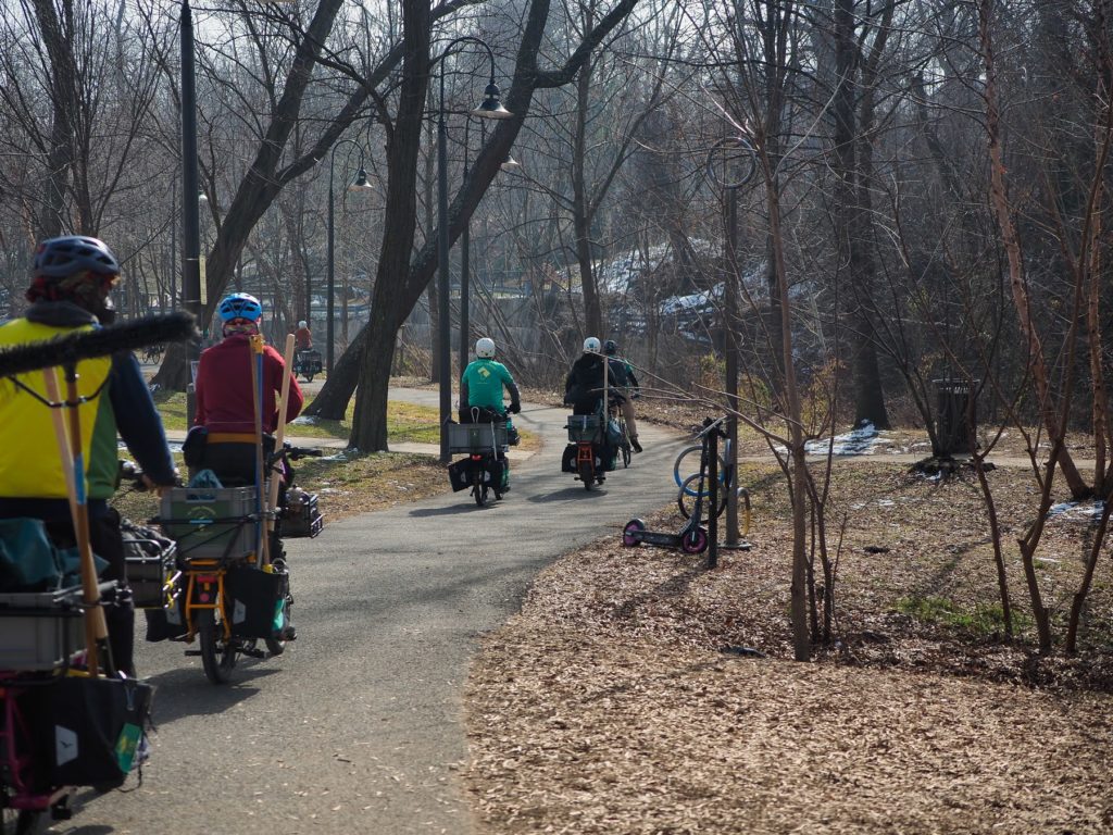
Trail Rangers are a consistent and helpful presence on DC’s mixed-use, paved trails, charged with assisting trail users, improving trail conditions, and working with local agencies to keep the trails clean, bright, and clear of obstacles. This amazing nonprofit program, run by the Washington Area Bicyclist Association (WABA), is made possible through a grant from the District Department of Transportation’s Urban Forestry Division, and was featured in the Esri case study “GIS-Driven Initiatives Promote Active Transportation in Washington, DC“.

OLYMPUS DIGITAL CAMERA

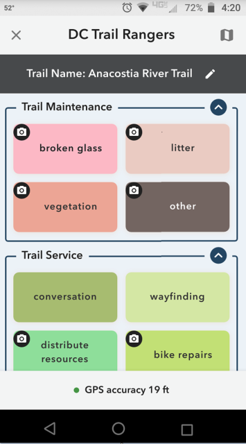
To help facilitate the data collection process and quantify work efforts, SymGEO was pleased to configure and deploy an ArcGIS QuickCapture application for the DC Trail Ranger team. Every trail service, maintenance task, work order request, or trail-side event is now captured by location with optional notes or photographs and tagged to the appropriate trail.

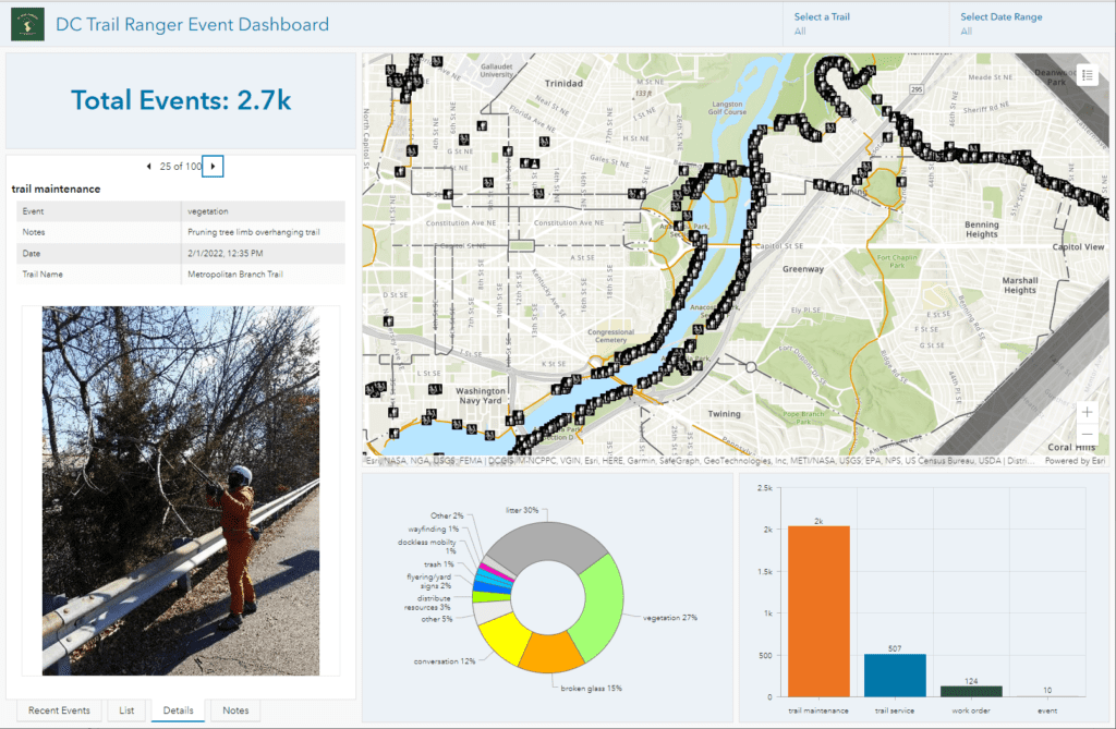
To assist with task management, the collected data was used to populate an internal ArcGIS Dashboard that lists all tasks and events by Trail Ranger and the date of the event. A public-facing version of the dashboard allows great visibility into all the activities undertaken by the Trail Rangers to better DC’s collective trail experience.

“As a field team that does a wide variety of outreach and maintenance tasks, ArcGIS QuickCapture has been great for record-keeping and storytelling of program impact. I can confidently say that staff stopped to sweep up broken glass in February 97 times!”

– Trail Ranger and Outreach Director, Washington Area Bicyclist Association

Talk to SymGEO industry experts today if your agency or organization is interested in data collection with the power of Esri’s ArcGIS QuickCapture technology –  we are an award-winning, certified Esri business partner and are here to help.

Urban Tree Canopy Change Storymap

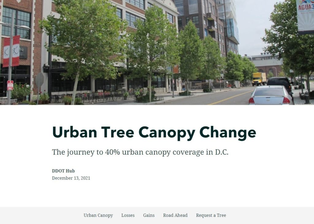
DDOT’s Urban Forestry Division (UFD) is the primary steward of Washington, D.C.’s ~175,000 public trees and has a mission of keeping this resource healthy, safe, and growing. Among many other benefits, these trees improve our air and water quality, cool our neighborhoods, and provide critical habitat for many animals. While D.C.’s Urban Tree Canopy (UTC) is already at an impressive 38%, the UFD has a goal of 40% by 2032. To learn more about the gains and losses experienced during the journey to 40%, SymGEO recently partnered with the UFD to create a StoryMap that explores example areas throughout D.C. and lays out the steps needed to reach the 40% canopy coverage goal.

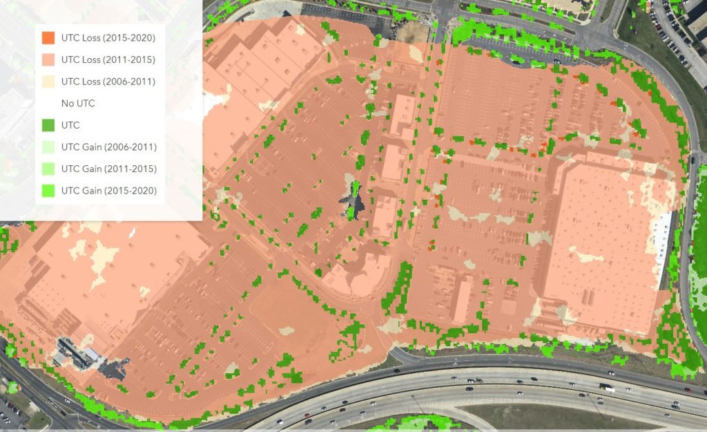
This mobile-responsive story begins with an overview of the current canopy coverage in DC and explores select examples detailing areas of loss and areas of gain.

Areas of loss are typically due to commercial developments, new residential developments, supporting road and transportation infrastructure, or individual tree loss due to natural causes or storm damage. 

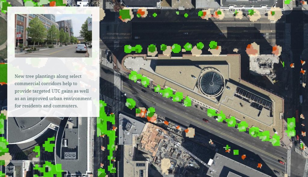
Areas of gain can be attributed to plantings along commercial corridors, or in new residential developments to help alleviate the urban heat island effect, or due to the natural growth of trees over time.

Finally, a call to action is made for homeowners to request their own free shade-providing tree, or to report an open planting box ready for a new tree.

Talk to SymGEO industry experts today if your agency or organization is interested in community engagement with the power of Esri’s ArcGIS StoryMap technology –  we are a certified Esri business partner and are here to help.